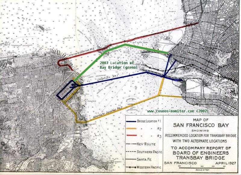
1927 Routes for the Bay Bridge
This map shows alternatives considered for the San Francisco-Oakland Bay Bridge during earlier planning for the span. This map dates from 1927. On the scan of the map below, I have indicated in green the approximate location of the current bridge. It's not precise, especially for the eastern span. The eastern span's location will shift anyway as a consequence of construction of the new bridge between Yerba Buena Island and Oakland.