What It Used to Look Like
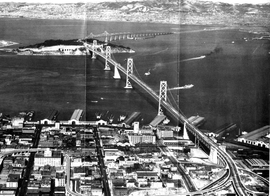
This aerial photo looks east across the Bay from downtown San Francisco. The Berkeley and Emeryville shoreline is in the background. In the foreground is the elevated loop to the Transbay Terminal, still mostly in use. The piers also look much the same, but much, much else has changed in this and other parts of San Francisco. The bridge has changed, too. At the time, automobile traffic was entirely on the upper deck, going in both directions, with train and truck traffic on the lower level. Subsequently, the train tracks were removed with the demise of the Key System. Currently, westbound traffic is on the upper deck; eastbound traffic is on the lower deck.