A Bay with No Bridges Close-Up
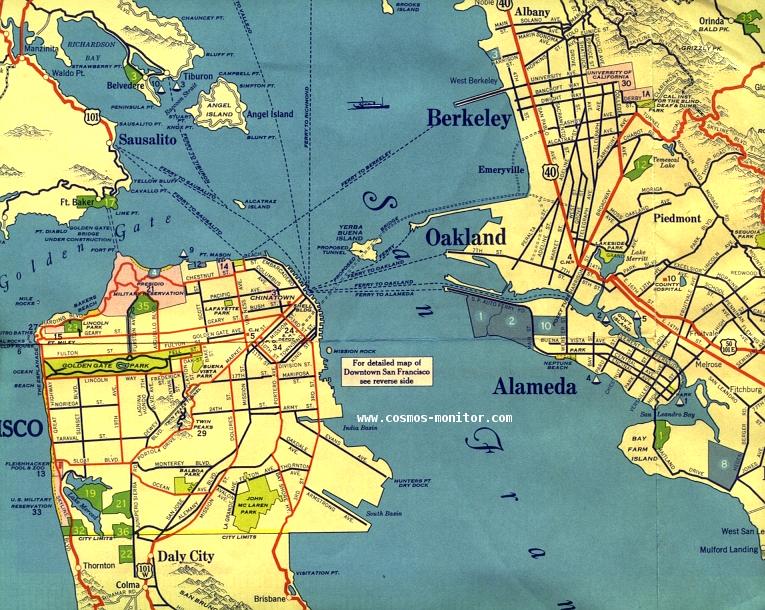
This is a close-up view of a fair use excerpt from a 1932 H.M. Goushá map, showing the ferry and land routes in the Bay Area before the Golden Gate and Bay bridges were built later in the decade. The proposed routes of the new bridges are also shown on this map. You can also see the major streets of the time in San Francisco, Oakland, and Berkeley.