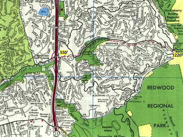
When reviewing some H.M. Goushá street maps of Bay Area cities, this line on an Oakland map (fair use excerpt above) jumped out at me. It is the route of a proposed highway that would have provided an alternate route to California 24 between Oakland and Orinda.
An article in the Montclarion, an Oakland neighborhood newspaper, described the history of the route, which would have run through Shepherd Canyon. Originally, the Sacramento Northern Railroad ran an electrified route through the hills. There was a tunnel at Gunn Drive. When rail service ended in 1957, the tunnel was sealed off. Caltrans then proposed a route through the area. There would have been another tunnel as well.
To show how steep the hills are in the area, I have shown the elevation of each end of the proposed route on this map: from the west end to the east end, the elevation increases by nearly 700 feet. Thus, a tunnel would have been required to get over into Contra Costa County (just off the east end of the map).
Caltrans projected a daily traffic count of 100,000 vehicles per day by 1990. Naturally, that would have ruined the rustic nature of the neighborhood. After extensive opposition, the plan was withdrawn in 1972. The route remains "on the books" but is unlikely to be built. Instead, a bike path was established in 1975.
What's surprising about this map is that Goushá continued to show the proposed route as recently as 1988!
Source: "From a railway thoroughfare to a soccer field", by Erika Mailman, the Montclarion, September 30, 2003, page A3.