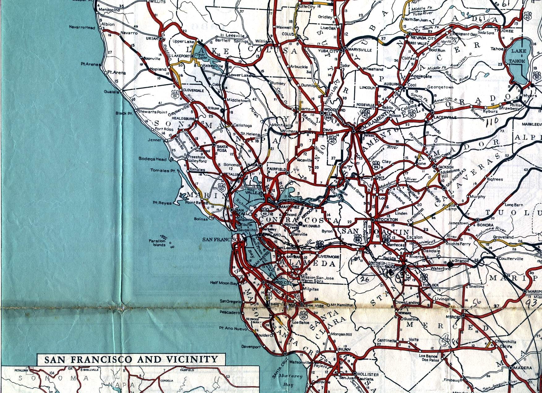
This section of the 1936 official California highway map shows the San Francisco Bay Area; the northern part of the Central Valley, including Sacramento, Stockton, and Modesto; the Gold Country, including Nevada City and Placerville; and the Lake Tahoe region.