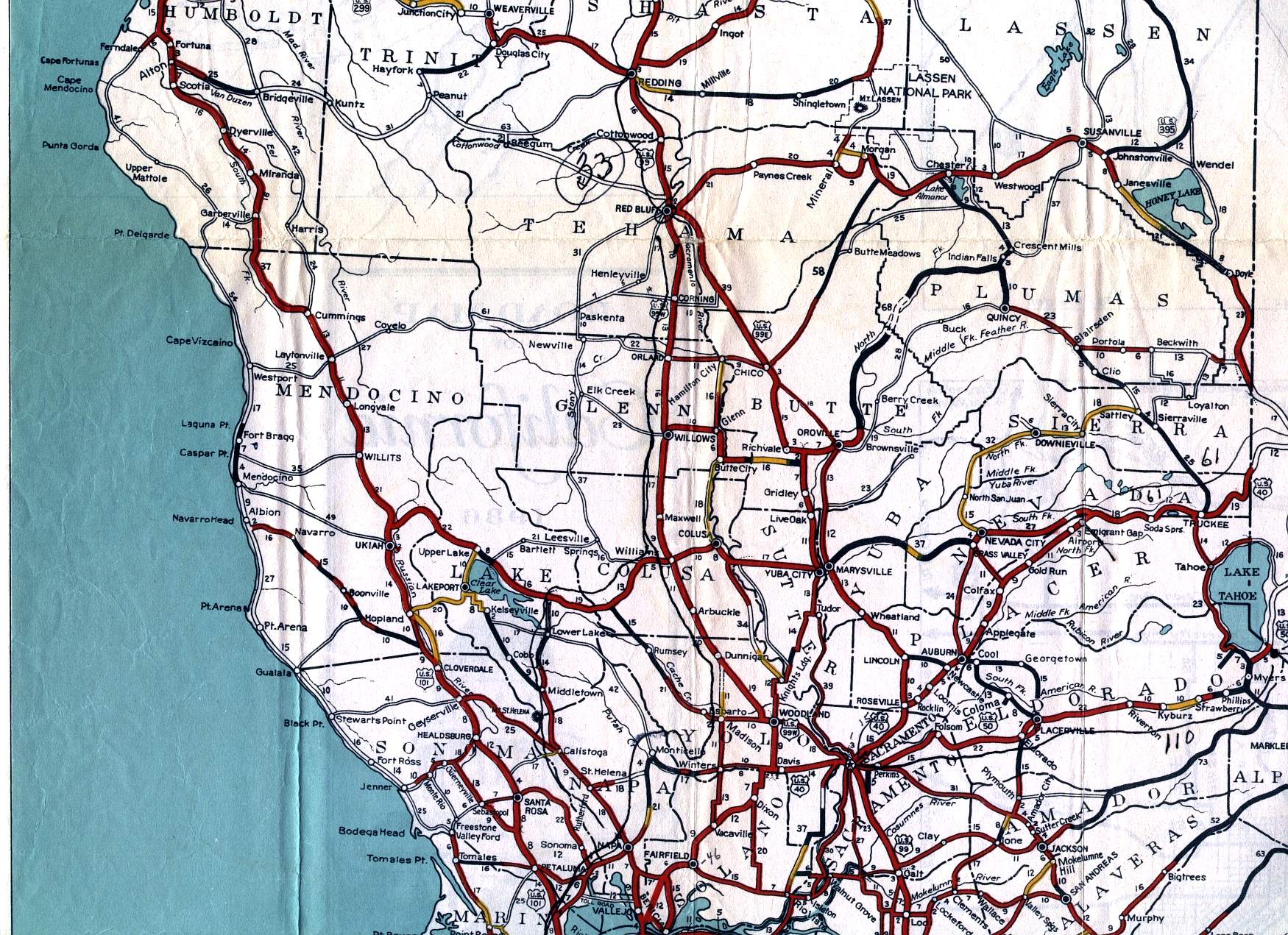
This section of the 1936 official California highway map shows the northern portions of the Central Valley and Gold Country, including Redding, Chico, Marysville, Nevada City, and Susanville; the Mendocino coastal regions; and Lake Tahoe.
This section of the 1936 official California highway map shows the northern portions of the Central Valley and Gold Country, including Redding, Chico, Marysville, Nevada City, and Susanville; the Mendocino coastal regions; and Lake Tahoe.