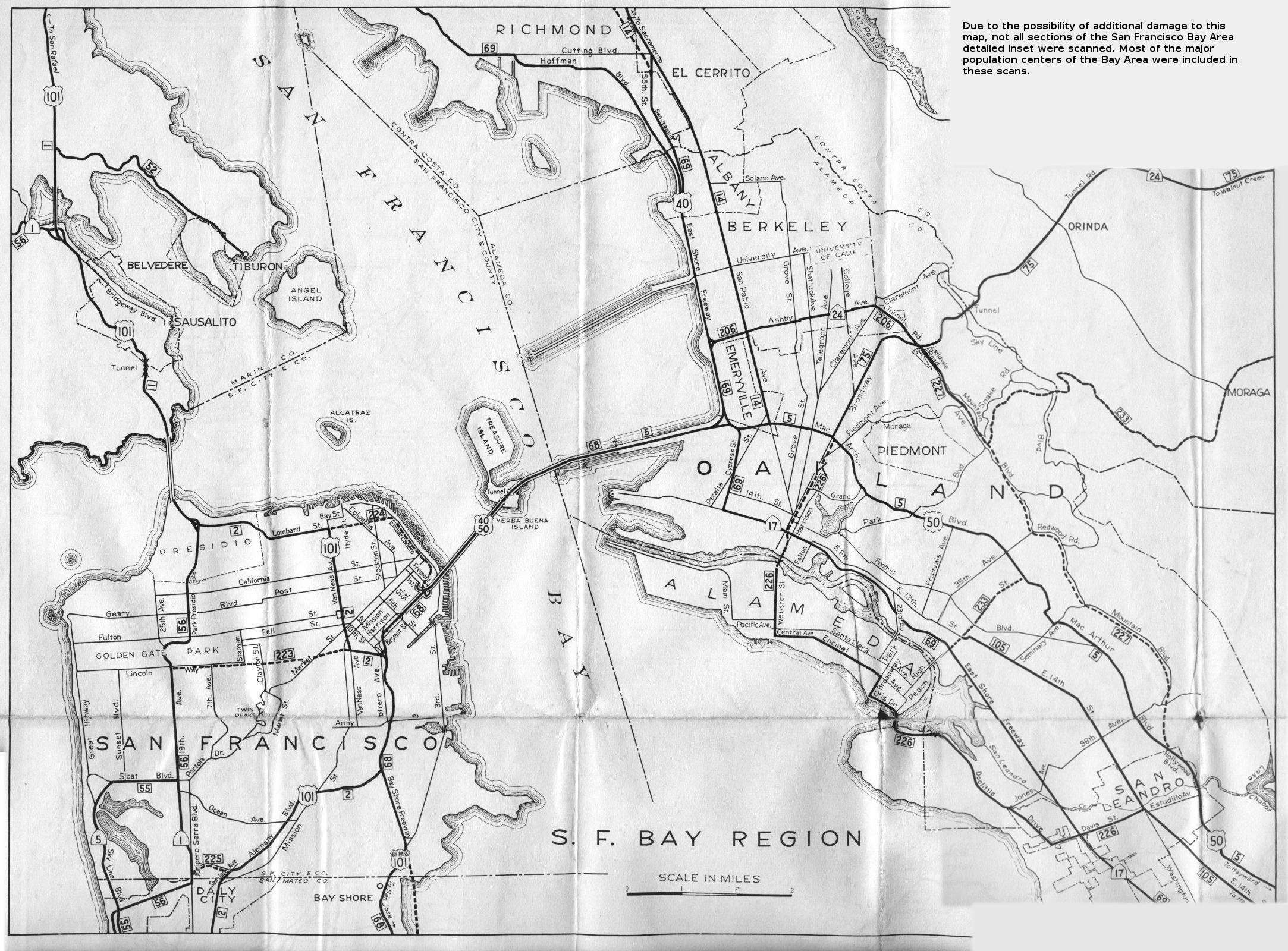
This is the detail map for the San Francisco Bay Region from the 1956 official California highway map. This map was on the rear side of the map along with detail maps for other California cities. The inset was too large for my scanner. This image was assembled from three separate scans, with scans omitted from some less-populated areas to avoid further damage to the map.
The major bridges are still here, though the eastern span of the Bay Bridge is being replaced along a parallel route between Yerba Buena Island and Oakland. In San Francisco, California 5 is now California 35. Bypass US 101, the Bay Shore Freeway, is now regular US 101. The equivalent to US 101 along Alemany Boulevard is now Interstate 280. Most of the route contemplated by proposed legislative route 223 was never built. California 1 is largely the same today.
In the East Bay, California 24 is now a freeway; the Ashby Avenue portion of the route is now California 13. US 40's modern-day equivalent is Interstate 80, while US 50's modern-day equivalent is Interstate 580. The dotted line for proposed legislative route 227 became the Warren Freeway (California 13) between California 24 and about Seminary Avenue in Oakland. California 17 is marked on this map as the East Shore Freeway, which is now Interstate 880. Legislative route 14, San Pablo Avenue in Berkeley and Emeryville, has become California 123. East 14th Street in Oakland, renamed International Boulevard, is California 185. The state highway route through Alameda is now California 61.
You can compare this map to the wider coverage shown with the color inset on the front of the main map.