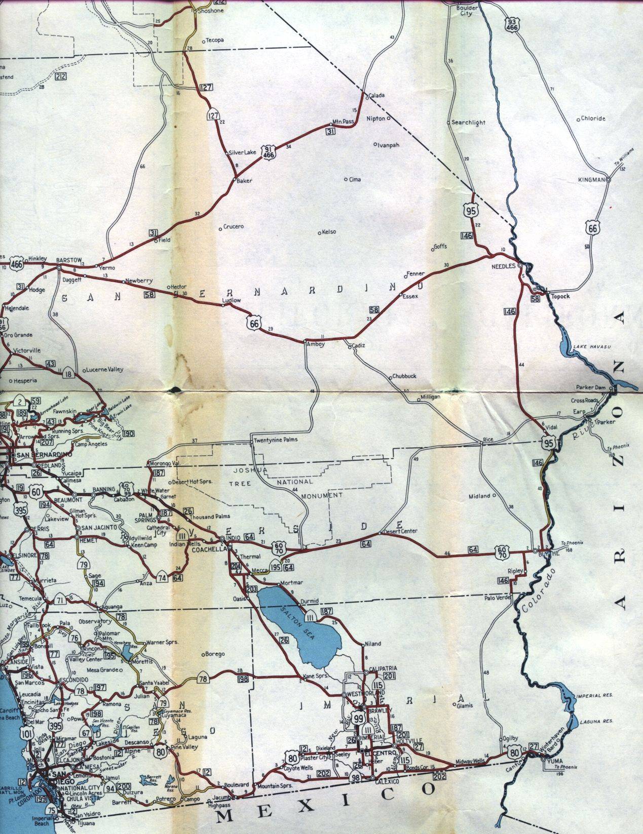
This section of the 1956 official California highway map shows the southeast corner of the state, including Barstow, Needles, Palm Springs, and the Imperial Valley.
This section of the 1956 official California highway map shows the southeast corner of the state, including Barstow, Needles, Palm Springs, and the Imperial Valley.