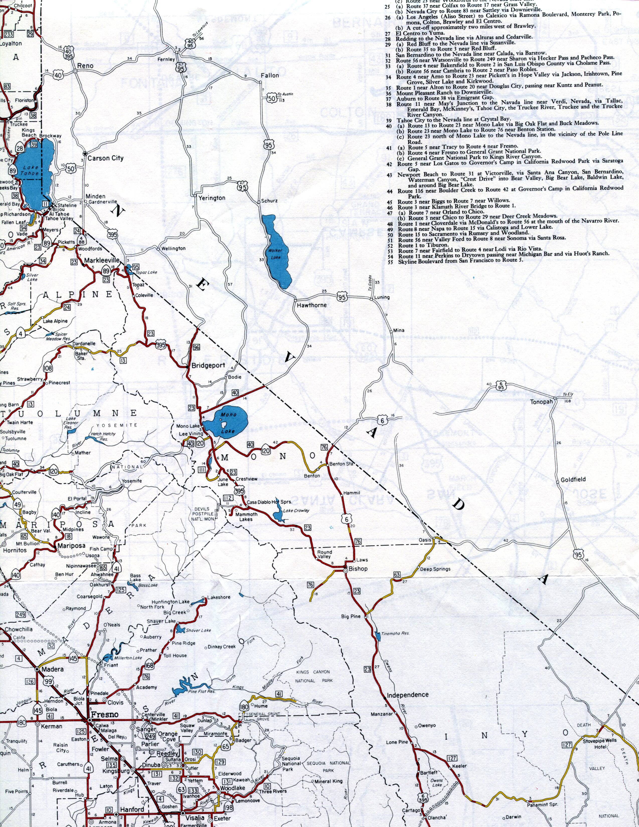
This section of the 1961 official California highway map is centered on Yosemite National Park and Mono Lake. The northern section of the US 395 corridor east of the Sierras is shown, as well as Lake Tahoe. Also shown in its entirety is California's smallest county, Alpine. A small part of the Central Valley around Fresno also appears.