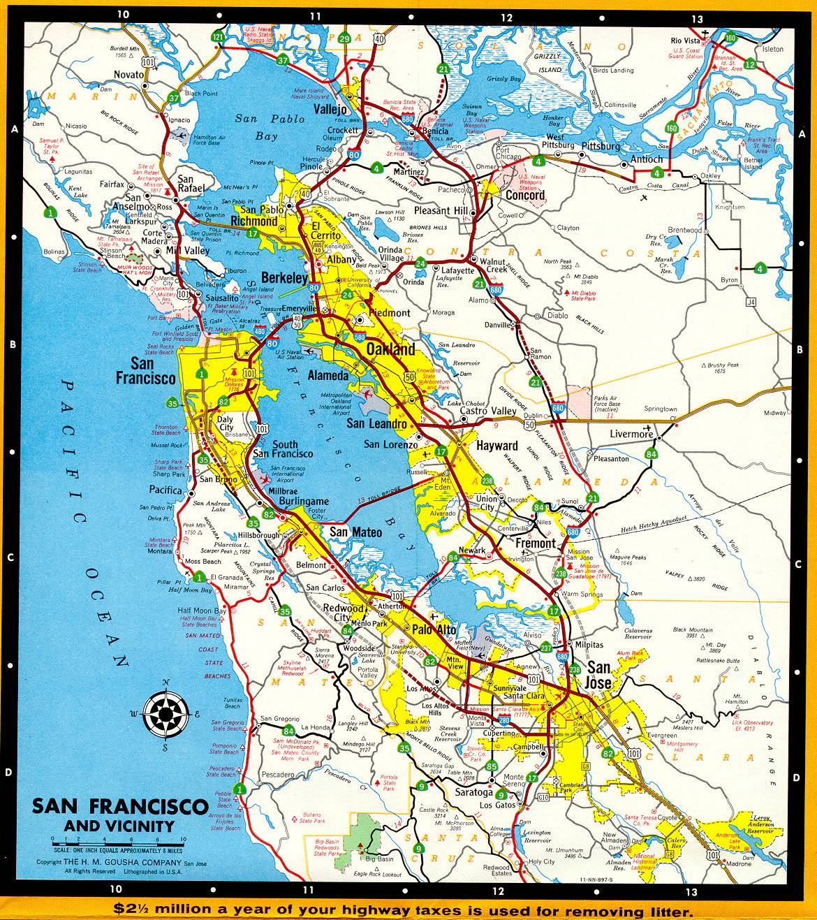
This excerpt from the 1966 official California highway map shows the a more detailed map of the San Francisco Bay Area. In contrast to the Los Angeles area, many of the major Bay Area freeways had already been built. Still unbuilt were Interstates 280 and 680, and some sections of Interstate 580, California 24, and California 242. California 237 from Sunnyvale to Milpitas was not yet a freeway. The California 17 designation extended all the way to Oakland (it's now Interstate 880). More freeway development still awaited San Jose and the South Bay. Interstate 480, the Embarcadero Freeway in San Francisco, was torn down as a result of the 1989 Loma Prieta earthquake.