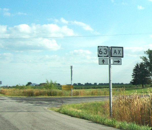
Photo courtesy of John Brocato (taken August 2006)
It's shown up on the 2005 official Missouri map, and here's photographic evidence of the only Missouri supplemental route that uses the letter X. Route AX extends west from US 63 at the Macon county village of Axtell, crossing Long Branch Lake and ending at Route O three and half miles west of Axtell.
Route AX is a relatively recent addition to the Missouri highway system. Earlier maps do not show it. Detailed county maps show the route as a county road. When I was last in the area in 1998, the route was a county road with no state designation.