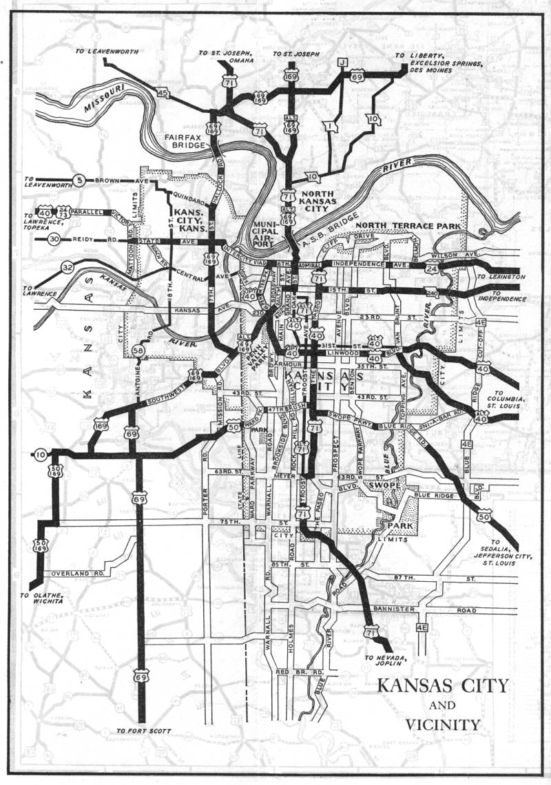
Inset map for Kansas City and the surrounding area from the 1938 official state highway map. Note the misspelling of Wornall Road as "Warnall". The street name had been spelled correctly in 1937. The routes designated by rectangular markers were part of the Jackson County highway system.
From 1937 to 1938, "city routes" disappeared, with "alternate" routes making their first appearance. US 40 moved from McGee, Grand, and Oak to the Paseo. Most of the former route of US 40 became Alternate US 40. The designation of Alternate US 40 along 31st Street appears to have replaced Optional US 40, though it may have replaced US 40 instead. The map wasn't clear on this point. US 69 moved from Grand to 15th to Baltimore to Southwest Boulevard to 7th Street in Kansas City, Kansas. The former US 69 route became Alternate US 69 and Alternate US 169. US 71 moved from Troost/15th to the Paseo; the former US 71 route became Alternate US 71. US 24 didn't change at all; even into the 21st century, it still was running along Independence Avenue and Admiral Boulevard.