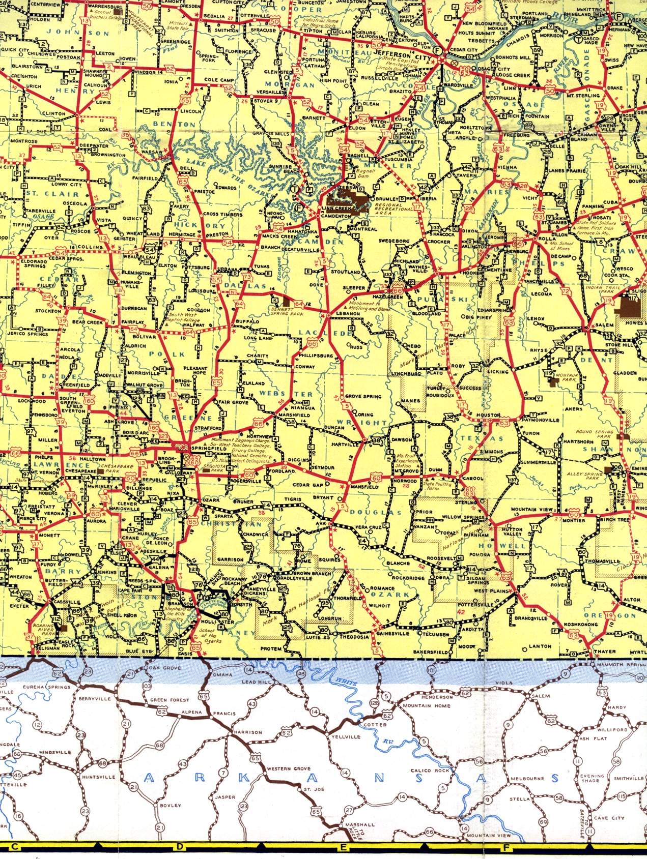
This section of the official highway map for 1940 shows the south-central portion of the state, including Lebanon, Rolla, Springfield, West Plains, and Willow Springs.
This section of the official highway map for 1940 shows the south-central portion of the state, including Lebanon, Rolla, Springfield, West Plains, and Willow Springs.