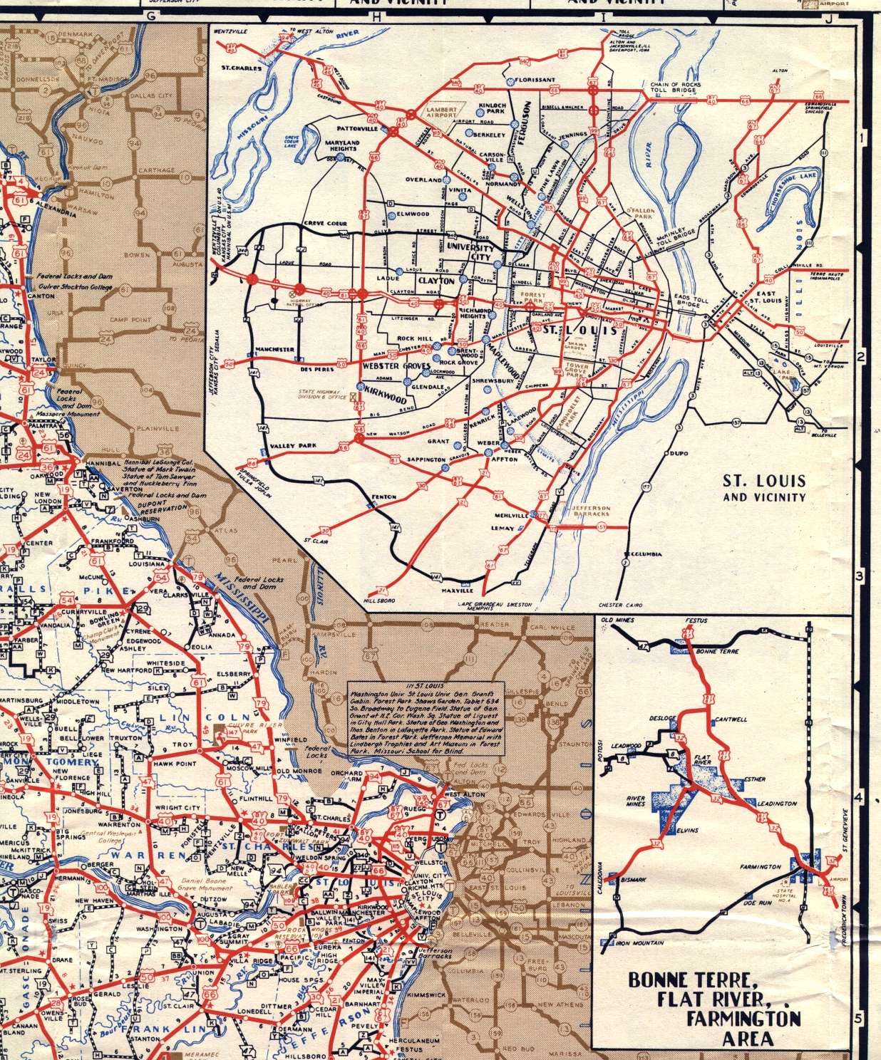
This section of the 1948 official highway map shows the northeast corner and the east-central section of Missouri, including Hannibal, St. Charles, and St. Louis. Also shown is an inset map for the St. Louis metropolitan area, as well as an inset map for Bonne Terre, Flat River, and Farmington in southeast-central Missouri.