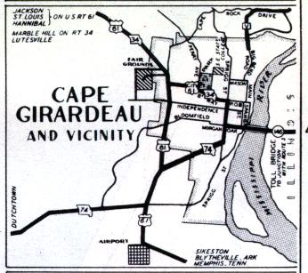
The inset map for Cape Girardeau, from the official 1950 Missouri highway map. Aside from the introduction of Interstate 55, the later addition of Missouri 177 (part of which is shown here as Route V), and the removal of state routes from Broadway (shown here as City Route 61 and Missouri 34), the routes on this map aren't much different than they are today.