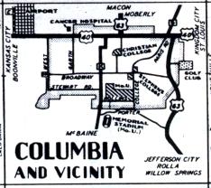
The inset map for Columbia, from the official 1950 Missouri highway map. At the time, the Columbia inset map was the same size as the Moberly or Mexico inset, indicating that the towns were of roughly equivalent size. Columbia was just embarking upon rapid population growth that would make it the biggest city in central Missouri. The only current route recognizable from this map is Route B. US 40 is now Business Loop 70. Route K is now Missouri 163. US 63 is on an entirely different alignment. The portion of US 63 north of US 40 is now part of Missouri 763. Even the airport is in a different location, southeast of Columbia.