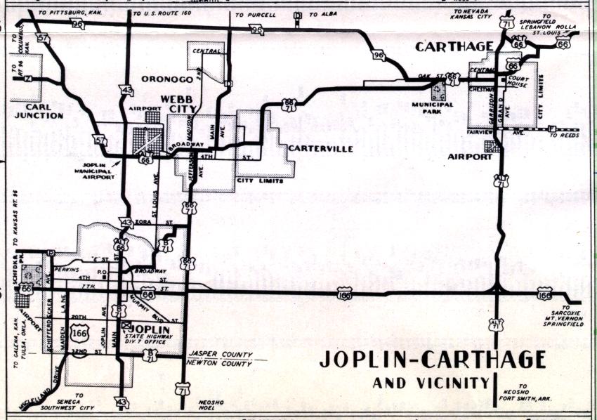
The cities of the Joplin-Carthage area were shown on a combined inset map for the official 1950 highway map. The two constants between then and now appear to be Missouri 43 and 96. US 166 has been largely replaced by Business Loop 44 and Missouri 66, US 71 is on a totally different alignment; what was then US 66/71 is now Business US 71. Then-Alternate US 71 is now either the US 71 freeway or Missouri 59.