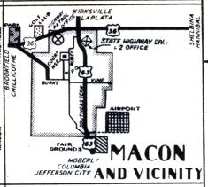
The inset map for Macon, from the official 1950 Missouri highway map. US 36 has been realigned slightly along a divided limited-access segment just to the north and paralleling the route of US 36 shown here, which is now Business US 36. US 63 is largely the same. The route shown with the thick line between US 36 just northwest of the city and Burke Street was shown on later maps as Spur US 36. That designation no longer exists.