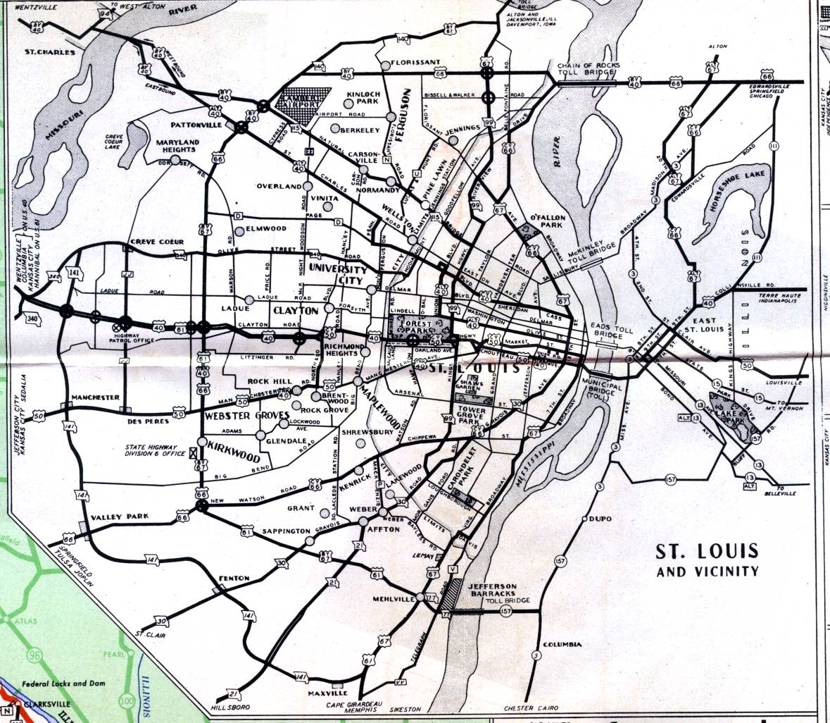
The inset map for the St. Louis metropolitan area on the official 1950 state highway map shows St. Louis and its multiple suburbs. The big outer loop at the time was formed by what is now Lindbergh Boulevard. The US 40 freeway was already present in St. Louis County, with interchanges shown by the big circles. Note that US 66 did not go into St. Louis City; instead, City Route 66 went there along Watson Road, Chippewa AVenue, and Gravois Avenue. A variety of "truck", "bypass", "alternate", and "city" routes were all in use. A few route designations no longer appear. Missouri 77 by Mehlville and the Jefferson Barracks Bridge has been replaced by Interstate 255. Missouri 140 near Florissant is now US 67. Missouri 99 no longer exists. The section north of St. Louis City is now Missouri 367. Manchester Road, US 50 on this map, is now Missouri 100.