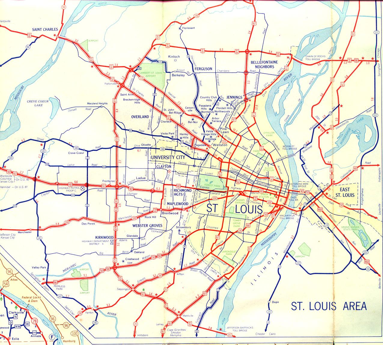
This is the inset map for St. Louis from the 1956 official state highway map.
Changes since 1956 to the routes shown on this map include:
- US 66, Bypass US 66, and City US 66 have been decommissioned.
- Bypass US 40 has been decommissioned. Its modern equivalent is Interstate 70 and Interstate 270.
- Alternate US 40 has been decommissioned. St. Charles Rock Road is now designated Missouri 180.
- City US 40 and Truck US 40 have been decommissioned.
- Lindbergh Boulevard, once home to multiple designations, is now US 67 along almost all its length. The routing of US 61 along the southwestern arc of Lindbergh is largely unchanged. US 50 also goes along the southern portions of Lindbergh.
- Bypass US 67 has been decommissioned.
- As shown here from the northeast endpoint of Lindbergh south to Riverview, US 67 is now Missouri 367.
- As shown here from the southeast endpoint of Lindbergh north to the St. Louis city line, US 67 is now Missouri 267.
- What is called "New Watson Road" on this map is now Watson Road. Watson Road and Chippewa Avenue in the city of St. Louis are now Missouri 366.
- Kingshighway in the city of St. Louis no longer carries a route designation.
- Route V (Telegraph Road) in South County is now Missouri 231.
- The alignment of US 40 east of North-South Road has changed, but to the west of that point, it hasn't. In addition, US 40 now also carries the designation of Interstate 64.
- Route JJ between Olive Street Road (Missouri 340) and US 40 has been decommissioned.
- The segment of Route AB from Interstate 270 (just to the west of, and parallel to, Ballas Road) to Lindbergh has been decommissioned.
- Near Lambert Airport, Routes BB and TT have been decommissioned.
- The section of Natural Bridge Road west of Lindbergh is now Route B.