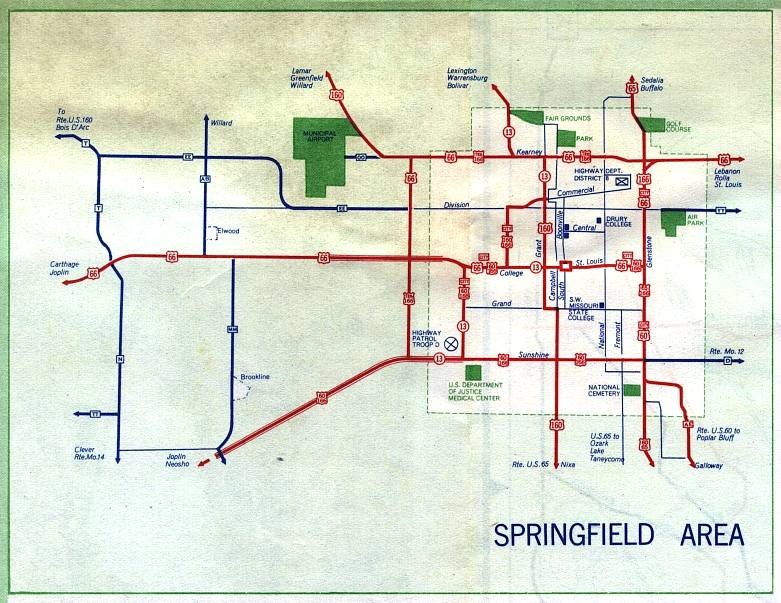
This is the inset map for Springfield from the 1958 official state highway map. Routes shown on this map were US 60, US 65, US 66, US 160, US 166, Truck Route 166, and city routes for US 60, 66, and 160. US 60 and US 166 were concurrent though south Springfield (Sunshine). US 65 ran along Glenstone Avenue. All three city routes, 60, 66, 166, were concurrent along College and St. Louis in the central part of Springfield. All numbered routes were shown in red. In addition, supplemental route AE in southeast Springfield was shown in red. It might also have been City Route 60, though that's not clear from the map.