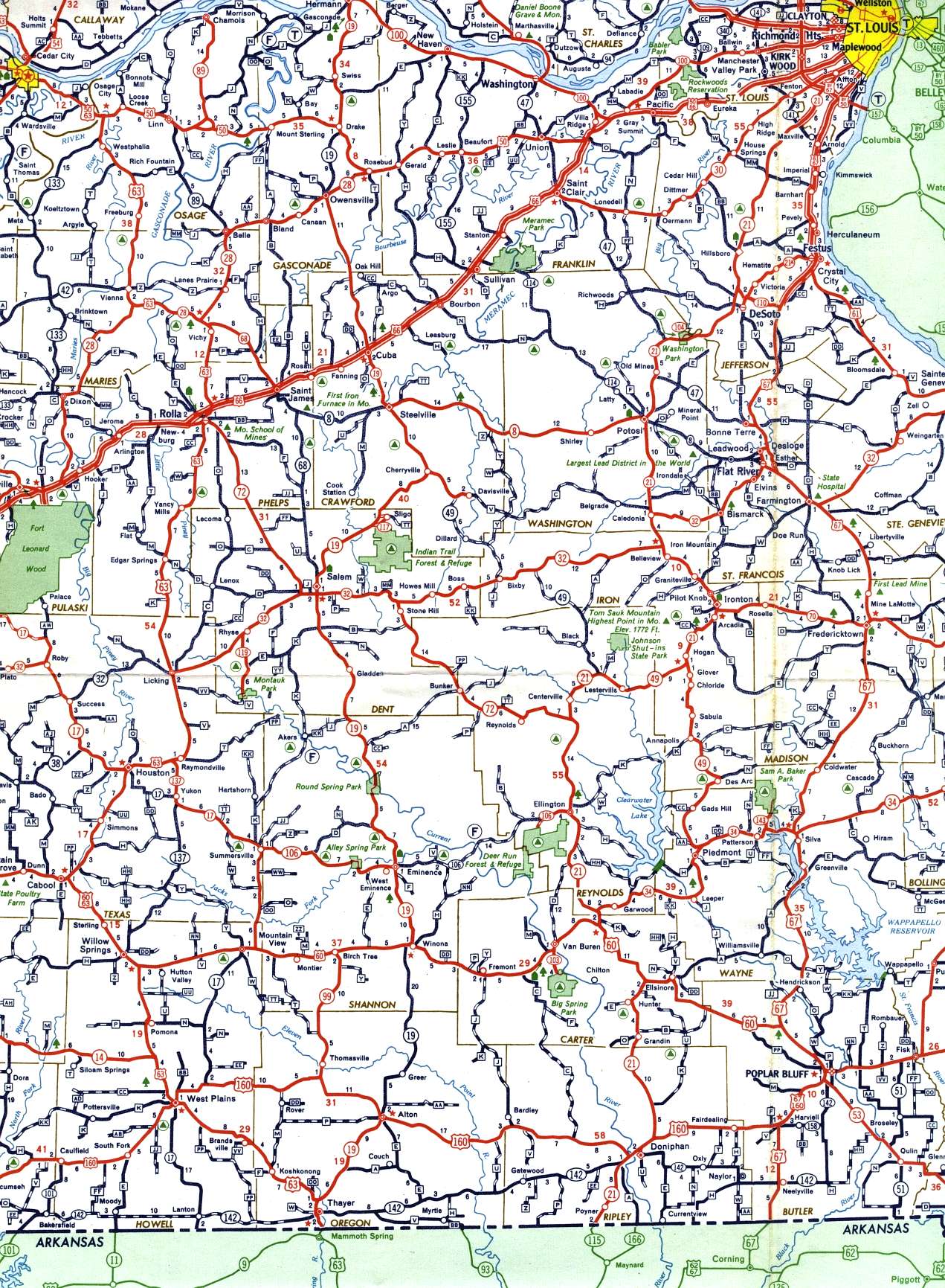
This section of the 1958 official highway map shows the southeast-central portion of the state, including the Bonne Terre-Flat River-Farmington area, Poplar Bluff, Rolla, and Washington.
This section of the 1958 official highway map shows the southeast-central portion of the state, including the Bonne Terre-Flat River-Farmington area, Poplar Bluff, Rolla, and Washington.