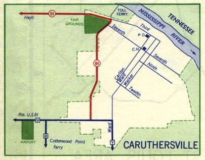
This is the inset map for Caruthersville from the 1959 official state highway map. The only numbered route shown on this map was Missouri 84 (in red).
In 1958, Missouri 84 went to downtown Caruthersville where it ended at Ward Street. By 1959, Missouri 84 had been extended along the west side of the city to end at Route U.
In turn, Route U had run along Ward Street from Third Street to Route Y; in 1959, Route U was truncated at the new Missouri 84 intersection, with Route Y making a dogleg turn to meet with that intersection. As a consequence, Ward Street in most of Caruthersville ceased being a state route.