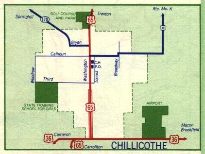
This is the inset map for Chillicothe from the 1959 official state highway map. Numbered routes shown on this map were US 65 and US 36 (in red) and Missouri 170 (in dark blue). US 65 is shown as a divided highway through part of Chillicothe.
Between 1958 and 1959, Route V northeast of Chillicothe had been paved.