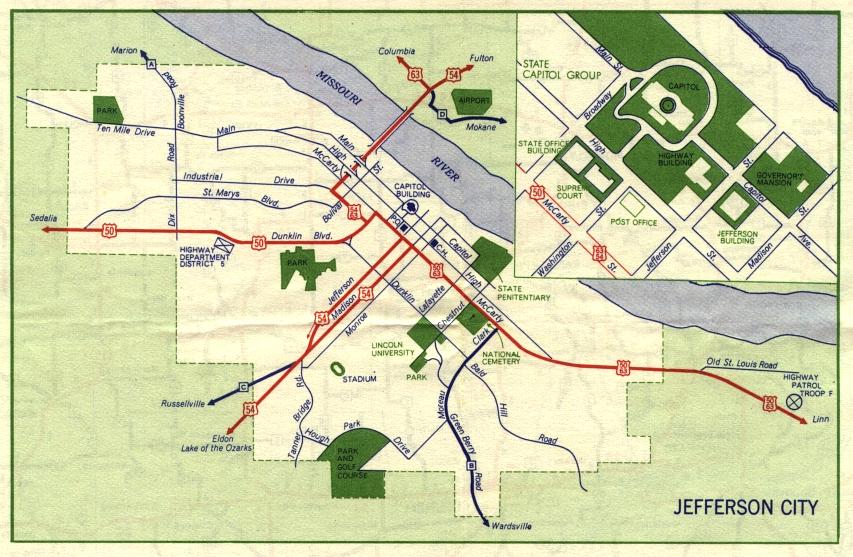
This is the inset map for Jefferson City from the 1959 official state highway map. Three numbered routes were shown on this map: US 50, US 54, and US 63 (in red). Alternate US 54, which was shown on the 1957 inset map, had disappeared by 1958. The arrow on Jefferson Street may indicate that Jefferson and Monroe were parallel one-way streets. US 50 and US 63 were concurrent through much of Jefferson City while US 54 and US 63 were concurrent from Jefferson City to their junction just across the Missouri River. Those concurrencies remain today, even though the routes have shifted over time.