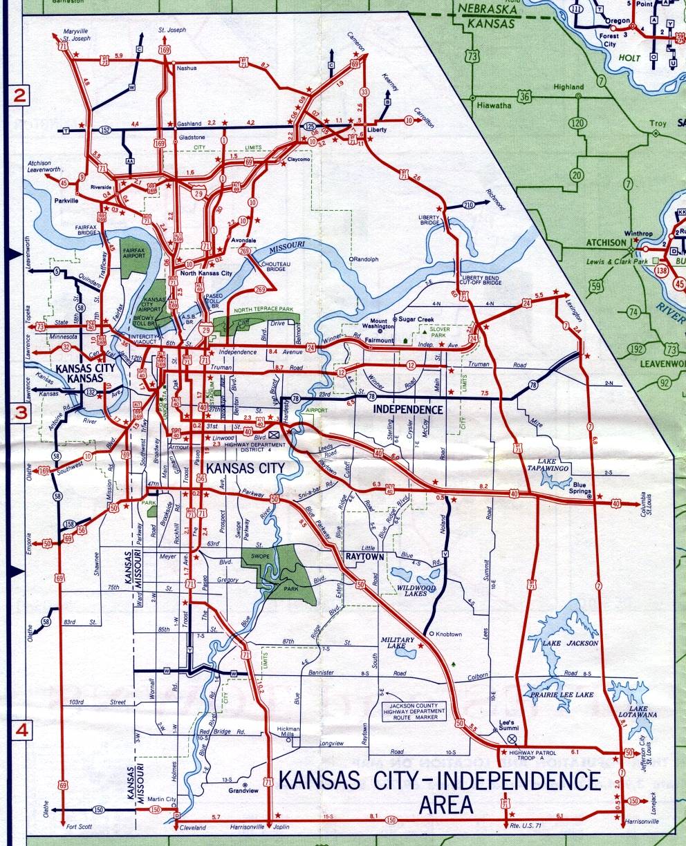
This is the inset map for Kansas City from the 1959 official state highway map. Numbered routes shown on this map were US 24, Interstate 29, US 40, Alternate US 40 (in Kansas City, Mo.), Optional US 40 (also in Kansas City, Mo.), US 50, US 56 (which appeared to end on the Paseo at Linwood Boulevard), US 69 (north of the Missouri River and in Kansas), Alternate US 69 (mostly in Kansas City, Mo. on both sides of the river), US 71, Bypass US 71 on the east and north edges of the metropolitan area, US 169 (north of the Missouri River and in Kansas), Alternate US 169, Missouri 1 (north of the Missouri River), Missouri 7 (far east side of the metropolitan area), Missouri 9 (in and near Parkville), Missouri 10 (north of the Missouri River), Missouri 12 (in Kansas City and Independence), Missouri 33 (north of Liberty), Missouri 45 (northwest of Parkville), Missouri 78 (in Kansas City and Independence), Missouri 150 (along the southernmost edge of the map, connecting with Kansas 150), Missouri 152 (north of Kansas City, Mo.), Missouri 210 (east of Bypass US 71 by the Liberty Bridge), Missouri 269, and Kansas state routes 5, 32, 58, 132, 150, and 158. US 73 appears only in Kansas City, Kansas.
Most numbered routes in Missouri were shown in red. The Missouri numbered routes shown in dark blue were Missouri 1 north of US 69, all of Missouri 78, all of Missouri 152, and Missouri 210. Kansas state routes shown in red were Kansas 10 and Kansas 32 in Kansas City.
This was the first year that an Interstate highway (I-29) was shown on the Kansas City inset map. You can see that I-29 extended south of the Missouri River. Although it's popularly believed that I-29 now ends at Interstate 35 north of the river, its southern endpoint is still marked just south of the Paseo Bridge, with I-29 and I-35 running concurrently between their junction north of the river and the south end of the bridge.