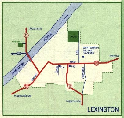
This is the inset map for Lexington from the 1959 official state highway map. Numbered routes shown on this map were Business US 24 and Missouri 13 (both in red). US 24, shown on the 1958 and earlier inset maps, had evidently been relocated to bypass Lexington on the south. However, that relocation does not show up on the main state highway map.
The former route of US 24 became Business Route 24 while the former Alternate US 24, which had paralleled US 24 through Lexington, disappeared entirely from the map, not even being shown as ordinary city streets. It had been Highland and Franklin streets.
Also between 1958 and 1959, Route CC, on the other side of the Missouri River from Lexington, had been paved.