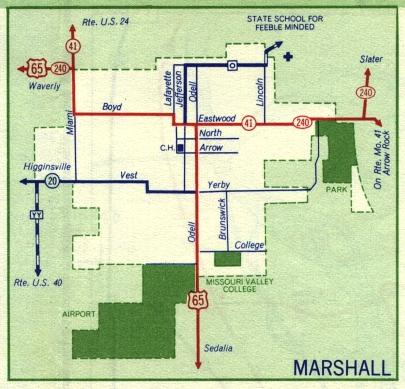
This is the inset map for Marshall from the 1959 official state highway map. Numbered routes shown on this map were US 65, Missouri 41, and Missouri 240 (in red); and Missouri 20 (shown in dark blue).
There were two changes to supplemental routes between 1958 and 1959. Route O, which had ended at Jefferson, extended south on Jefferson to meet US 65. Route YY was an entirely new route just west of Marshall off Missouri 20.