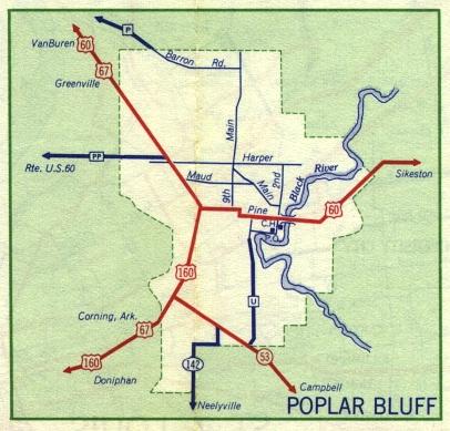
This is the inset map for Poplar Bluff from the 1959 official state highway map. Numbered routes shown on this map were US 60, US 67, US 160, and Missouri 53 (in red); and Missouri 142 (in dark blue). The 1959 inset map covered a smaller area than the 1958 map. Thus the 1959 map did not show the small town of Harwell southwest of Poplar Bluff, or Missouri 158 south of Harwell. The town and highway had been shown on the 1958 map.