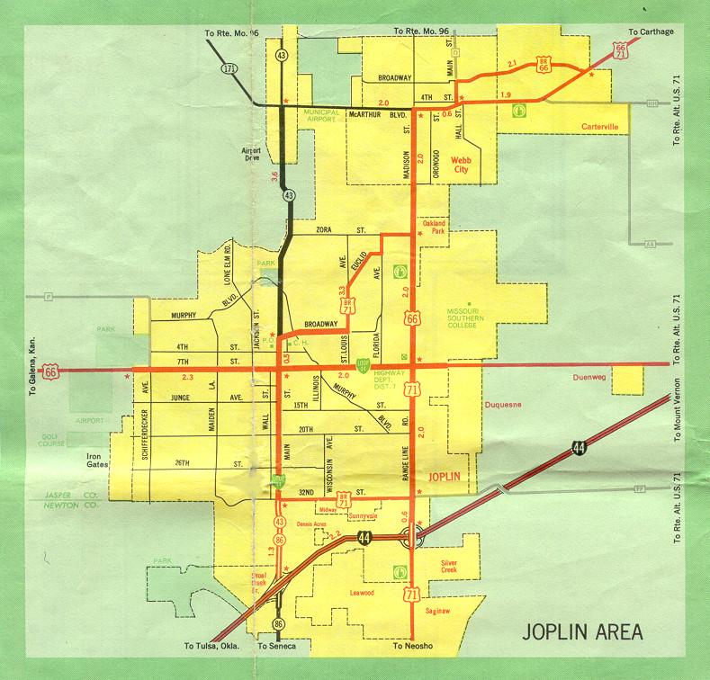
This is the inset map for Joplin from the 1969 official state highway map. Changes since then include:
- US 71 is now on a freeway extending south from Interstate 44 at an interchange just north of the Route FF overpass shown on this map.
- From that interchange eastward, US 71 is concurrent with Interstate 44.
- From that interchange northward, Missouri 249 has been built, ending at Zora Street, which has been extended eastward from Joplin and eventually meets Route AA.
- US 66 is now Missouri 66 west of Range Line Road. US 66 continues east from that point concurrent with Business Loop 44 (7th Street).
- North of Range Line Road and 7th Street along Range Line, US 66 is now Business US 71.
- US 71 on Range Line Road is now Business US 71.
- US 71 in Webb City and Carterville is now Business US 71 and Missouri 171.
- Business US 66 in Webb City and Carterville was decommissioned.
- In Webb City, Route D was extended south from Broadway to meet what is now Business US 71 at 4th Street.
- Business US 71 along 32nd Street in Joplin is now Route FF.
- The northern endpoint of Missouri 86 is now at its interchange with Interstate 44. It does not extend north of I-44.
- Oakland Park merged into Webb City in 1996.
- Midway and Sunnyvale merged into Joplin.