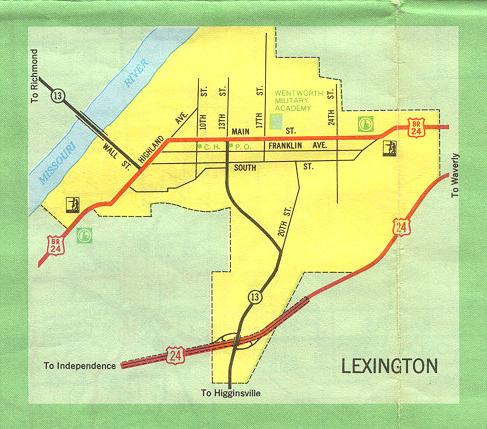
This is the inset map for Lexington from the 1969 official state highway map. There have been several changes since then, most occurring in 2005:
- The Missouri River bridge was replaced by a new bridge northeast of Lexington. As a consequence, Missouri 13 now joins US 24 at their interchange in the south part of Lexington. Missouri 13 proceeds eastward on US 24 for about three miles. A short freeway section has been built for the new bridge. Eventually, that freeway will bypass Lexington altogether on Missouri 13.
- Earlier, Business US 24 was replaced by Missouri 224. In addition, Missouri 224 no longer runs along Highland Avenue, but instead is on a route at the base of the cliff overlooking the Missouri River (Highland Avenue is at the top of that cliff). It is possible that this inset shows the routes incorrectly, because there has never been a direct connection between the old bridge and Highland Avenue. Wall Street also is aligned differently than shown here.