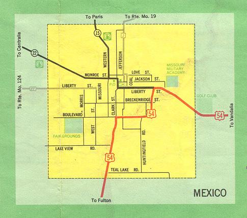
This is the inset map for Mexico from the 1969 official state highway map. Since 1969, US 54 has been moved to a new bypass southeast of Mexico. The 1969 route of US 54 is now Business US 54. Within Mexico, Missouri 15 and 22 were moved from Liberty Street to a new street, Muldrow, beginning on the north at Monroe Street and bypassing downtown Mexico to the west. Muldrow ends at Boulevard. Missouri 15 and 22 then run along Boulevard (that's its name) for a couple of blocks until joining Business US 54. Missouri 15 and 22 are concurrent with Business US 54 from that point southward to the interchange with US 54 south of Mexico.
In addition, Route FF now begins at the Mexico city line, proceeding westward from that point in Audrain County.
It is also interesting to note that this map does not show the village of Vandiver Village, an independent community just east of Mexico on what is now Business Route 54 by the "golf club".