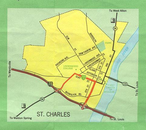
This is the inset map for St. Charles from the 1969 official state highway map. St. Charles still had an existence somewhat independent from St. Louis, but rapid growth in the years since then now place St. Charles definitely within the St. Louis metropolitan area. The 2005-2006 official highway map now shows St. Charles within its St. Louis area map.
Since 1969, the Missouri 115 bridge was torn down. In St. Louis County, Missouri 115 was redesignated Route A and later decommissioned altogether. The Missouri 370 freeway and bridge over the Missouri River was built north of St. Charles. At Interstate 70 and Fifth Street, the two looping ramps on the east side of the interchange have been removed.