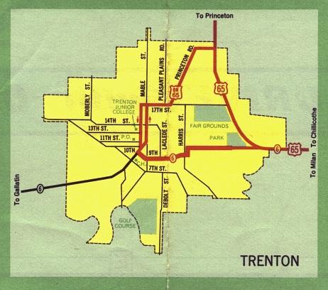
This is the inset map for Trenton from the 1969 official state highway map. This inset may look a little different from the previous version at this site. I obtained a "clean" version of the map, lacking my preadolescent scribblings on the copy of the map that I originally used for these scans.
Since 1969, the following changes have occurred:
- US 65 is routed on a new alignment toward the eastern edge of Trenton.
- Business US 65 has been moved to the former route of US 65 (also now called Oklahoma Avenue).
- The alignment of Business US 65 on this inset has mostly been decommissioned, except for a small segment of Princeton Road, which is now Route AA.
- The map erroneously refers to Pleasant Plain as "Pleasant Plains Road".