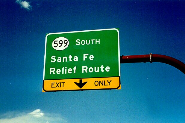
The Santa Fe Relief Route was a relatively recent project to build a bypass around the west and north sides of the state capital. In 2000, when this photo was taken, the road had been so recently completed that its full length appeared on only one map, the locally published Horton Family Maps street atlas of Santa Fe and nearby cities (1999).
Notable is the absence of the Zia symbol on this sign. That's the usual New Mexico practice on overhead signs such as this. The Zia symbol on highway markers is routinely found only on individual markers and not on "Big Green Signs".
The term relief route is unique to New Mexico. It usually refers to a bypass around a community. NM 585 between NM 68 and US 64 south of Taos is another relief route.
However, for many years, Lomas Boulevard in Albuquerque was signed as Relief US 66. It also carried an official state designation of NM 352 (which never appeared on signs).
Clouds and smoke from the May 2000 Los Alamos wildfires are visible in the background of this photo.