A Bay with No Bridges
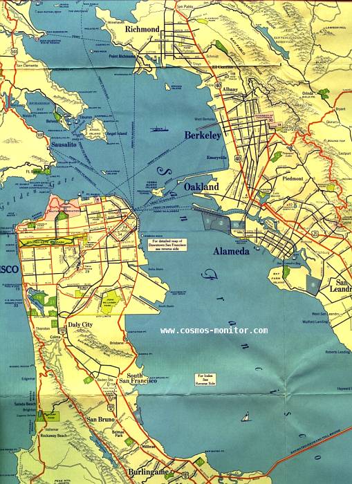
This fair use excerpt from a 1932 H.M. Goushá map shows the routes in the Bay Area before the Golden Gate and Bay bridges were built later in the decade. Also later in the 1930s, US 101 was a single route. But in 1932 US 101 was a split route. 101E was concurrent with US 50 in Oakland and San Leandro, while US 101W ran up the Peninsula, later becoming US 101.
I've also scanned a close-up look at the bay between San Francisco and Oakland, which more clearly shows the proposed bridge routes and the routes of the ferries that, at the time, were the only way to get from one side of the bay to the other.