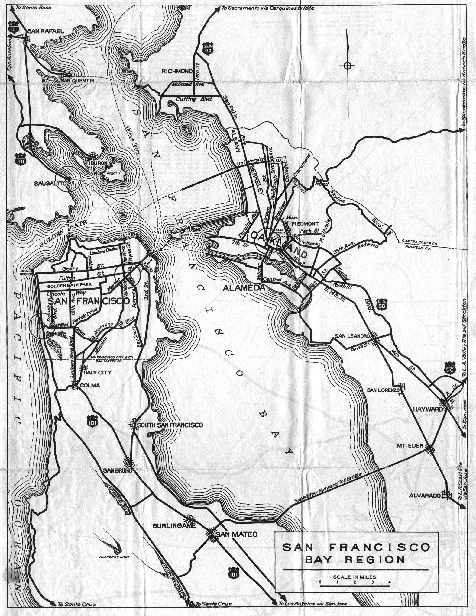
San Francisco, Oakland, and the San Mateo County peninsula were shown together on this inset map of the San Francisco Bay Region, on the back side of the 1936 official California highway map. Compared to the inset on the front side of the map, this one was in black and white and showed only the US highway designations in the area: US 40, US 50, and US 101.
Note that the Golden Gate Bridge and the San Francisco-Oakland Bay Bridge had not yet been completed. Thus they weren't shown on the map. Even after the completion of the Golden Gate Bridge, there was -- and is -- still a break in the designated route of US 101: because the Golden Gate Bridge is operated by an independent governmental district, the legislative designation of US 101 does not extend over the bridge. The point is moot for US 40 and US 50 across the Bay Bridge: they have been replaced by Interstate 80 and Interstate 580, respectively.