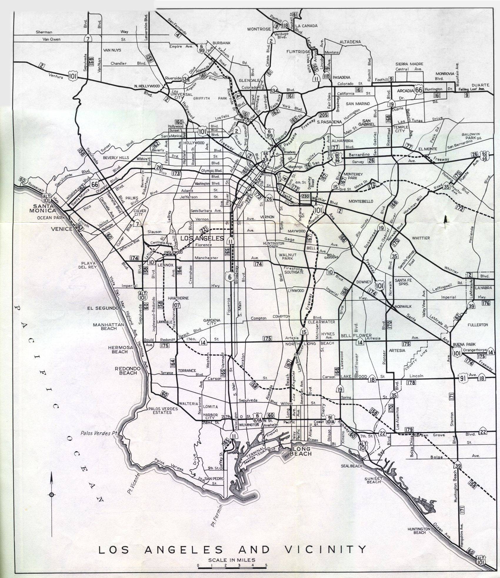
This is the detail map for Los Angeles from the 1956 official California highway map. This map was on the rear side of the map along with detail maps for other California cities. The inset was too large for my scanner. This image was assembled from four separate scans, with only the uppermost northwest corner missing (not scanned to avoid further damage to the map).
The changes to the Los Angeles area highway system since 1956 are too numerous to mention. The presence of US highways in the region is sharply reduced, with Alternate US 101, US 66, US 6, US 60, US 70, US 91, and US 99 either gone or replaced by state routes.
You can compare this map to the wider coverage shown with the color inset on the front of the main map.