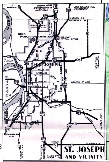
The inset map for St. Joseph, from the official 1950 Missouri highway map. The major routes are still the same, but the route numbers are sometimes different. US 71 now is co-signed with Interstate 29, which approximately parallels the Belt Highway to the east. The Belt Highway now only carries the US 169 designation. US 59 along Pear and Garfield Streets is now Business Loop 29. It continues along 10th Street and Frederick back to the Belt Highway. US 36 now runs along a freeway through the south-central part of the city. US 275 no longer reaches St. Joseph. Lake Avenue and St. Joseph Avenue are still US 59. Interstate 229 in St. Joseph, of course, did not exist at the time. Hyde Park Avenue is now Missouri 752. Even more notable, there is no longer a direct route to the airport from the rest of St. Joseph. After severe flooding in 1952, a cutoff channel for the river was formed, stranding the airport from the rest of the city. It now must be approached from Kansas via US 36 and K-238.