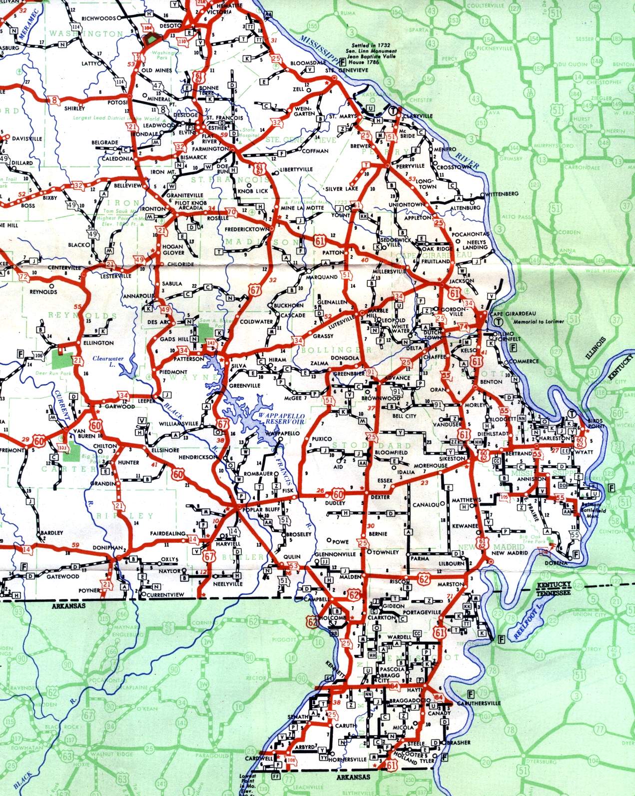
This section of the official highway map for 1950 shows the Bootheel and other areas in the southeastern part of Missouri, including Cape Girardeau, Caruthersville, Charleston, Kennett, Sikeston, and Poplar Bluff.
This section of the official highway map for 1950 shows the Bootheel and other areas in the southeastern part of Missouri, including Cape Girardeau, Caruthersville, Charleston, Kennett, Sikeston, and Poplar Bluff.