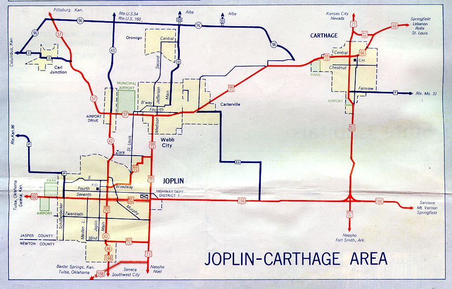
This is the inset map for Joplin from the 1957 official state highway map. Numbered routes shown on this map were US 66, Alternate US 66 (in Carthage), US 71, Alternate US 71 (through Carthage), Business Route 71 (in Joplin), US 166, Missouri 57, Missouri 86 (in red); Missouri 43 (in red where concurrent with Missouri 86, otherwise in dark blue); and Missouri 96 (in dark blue).
The 1957 route of US 166 may have been Business US 166. US 166 is shown in two locations. One is a new divided route connecting the Will Rogers Turnpike just over the border in Oklahoma to US 71 along the east side of Joplin. The 1958 Joplin-Carthage inset map shows the undivided route of US 166 through Joplin as Business US 166. It's possible that the 1957 map was incorrect with the new routes not shown until 1958.