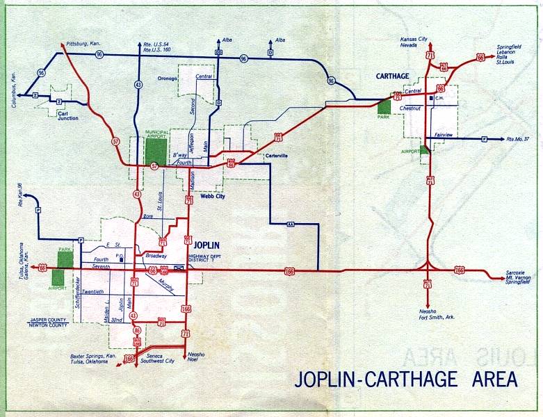
This is the inset map for Joplin, including Carthage, from the 1958 official state highway map. Numbered routes shown on this map were US 66, Alternate US 66 (in Carthage), US 71, Alternate US 71 (through Carthage), Business Route 71 (in Joplin), US 166, Missouri 57, Missouri 86 (in red); Missouri 43 (in red where concurrent with Missouri 86, otherwise in dark blue); and Missouri 96 (in dark blue).
The route of US 166 had shifted from the 1957 Joplin inset map. The 1957 route of US 166 became Business US 166. US 166 moved to a new divided route connecting the Will Rogers Turnpike just over the border in Oklahoma to US 71 along the east side of Joplin. However, that divided route also was shown on the 1957 map. It's possible that the 1957 map was incorrect with the new routes not shown until 1958.
There's also a mystery route on this map. The red route above Business US 66 in Webb City does not show a designation. Possibly it is a new route of US 66 and US 71. The Business US 66 route was shown as US 66 on the 1957 map, while the undesignated route was not shown at all. This would seem to be an odd placement of US 66/71 and Business US 66, though, because it would have amounted to using a business route as a bypass route. And by 1959, what was shown on this map as Business US 66 was shown again as US 66 and US 71, with the mystery route getting the designation of Business US 66.