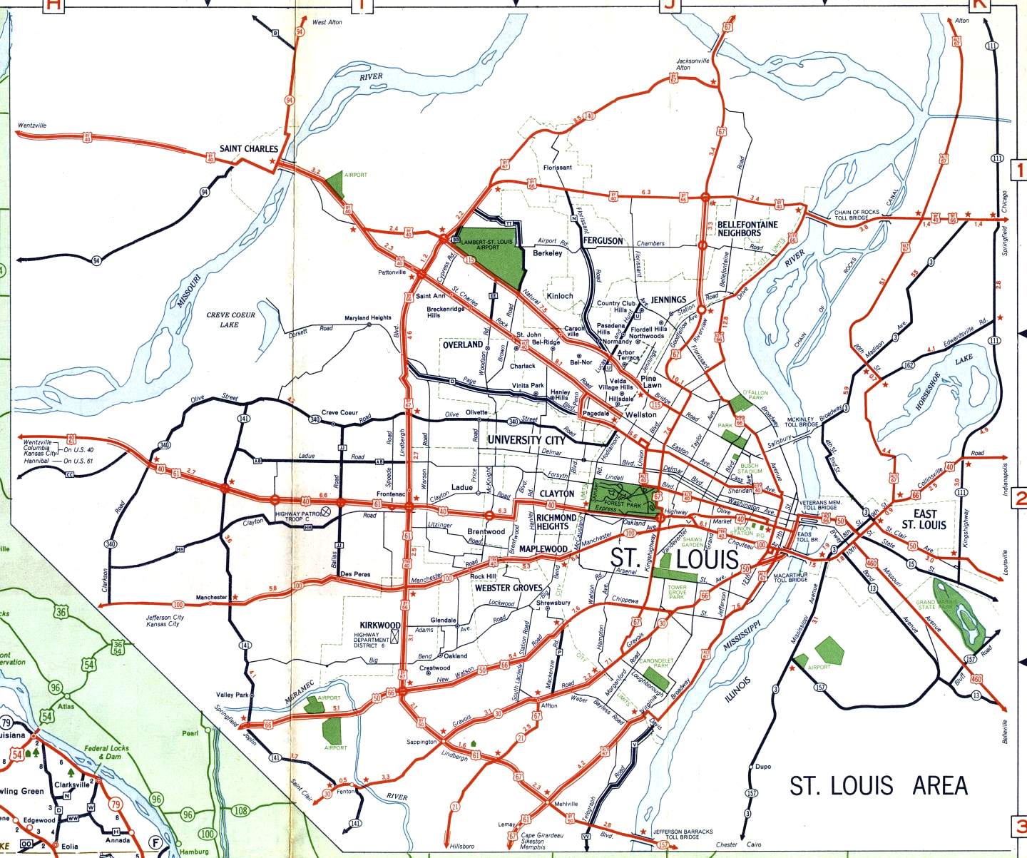
This is the inset map for St. Louis from the 1958 official state highway map. Numbered routes shown on this map included: US 40, Alternate US 40, Bypass US 40, City Route 40, Truck Route 40, US 50, Bypass US 50, US 61, US 66, Bypass US 66, US 67, Bypass US 67, Alternate US 67 (in Illinois), Missouri 21, Missouri 30, Missouri 94, Missouri 100, Missouri 115, Missouri 140, Missouri 141, Missouri 340, US 460 (in Illinois), and Illinois state routes. All numbered routes were shown in red except for part of Missouri 94, all of Missouri 141, all of Missouri 340, and all Illinois state routes. The one notable change from the 1957 St. Louis inset map was the indication of a divided highway on Bypass US 40 west of St. Charles. This highway soon became part of Interstate 70. Unlike the St. Charles inset map, Interstate highway construction was not shown on this map.