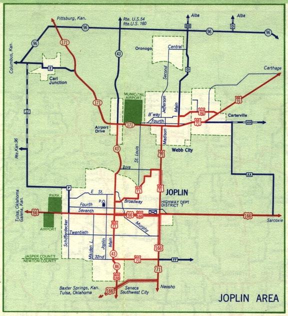
This is the inset map for Joplin from the 1959 official state highway map. Numbered routes shown on this map were US 66, US 71, Business Route 71, US 166, Business US 166, Missouri 57, Missouri 86, and Missouri 171 (in red); Missouri 43 (in red where concurrent with Missouri 86, otherwise in dark blue); and Missouri 96 (in dark blue).
For 1959, the inset maps for Joplin and Carthage had been separated for the first time. The 1958 official map showed Joplin and Carthage together on one inset map.
For 1959, Missouri 171 replaced Missouri 57, thus avoiding a numbering conflict in Missouri with Interstate 57. Several state routes were renumbered between 1958 and 1959 to avoid duplicating numbers on the newly established Interstate highway system in Missouri (even though Interstate 57 had not been built by 1959).