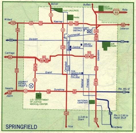
This is the inset map for Springfield from the 1959 official state highway map. Compared to the 1958 inset, the 1959 map covered about half the area. Brookline and Elwood, which had been shown on the 1958 map, were not covered by the 1959 map.
Interstate 44 makes its first appearance as a short segment of divided highway northeast of Springfield, extending west to end at US 65 just inside the city limits.
Other routes shown on this map were US 60, US 66, US 160, US 166, Truck Route 166, and business routes for US 60, 66, and 160. In 1958, the business routes had been labeled "city" routes.
US 60 and US 166 were concurrent though south Springfield (Sunshine). US 65 ran along Glenstone Avenue, concurrent in part with US 166. All three business routes, 60, 66, 166, were concurrent along College Street and the Chestnut Expressway in the central part of Springfield. While the Chestnut Expressway was not labeled on this map, a comparison with the 1958 inset clear shows that the routes had been moved to different streets. Based on the jog on the new route, I believe the new route ran along Chestnut Expressway instead of St. Louis Street.
All numbered routes were shown in red. Supplemental route AE in southeast Springfield was shown in dark blue, rather than in red as shown on the 1958 map.