Counties in which each endpoint is located are shown in parentheses.
Miniature pseudo-markers are shown for US, Missouri, Interstate, and Interstate Business Loop and Spur Routes (unless you chose the text-only display option). The markers are based on Shield Generator [replaced by Shields Up, (c) 2002 David R. Kendrick] with additional modifications. More about the markers here.
Where available, links are also shown to relevant Road Signs & Sights Gallery photos.
Abbreviations: MO = Missouri Route,
ALT = Alternate Route, SH = State Highway (for states other than
Missouri), SP = Spur Route, SR = Supplemental Route (the secondary
Missouri roads designated with letters).
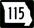
Missouri 115
Northwest Endpoint: I-70 Exit 237, Berkeley (St Louis)
Southeast Endpoint: I-70 Exit 248A, St Louis (St Louis City)
Principal Cities: St Louis
Counties: St Louis, St Louis City
Former endpoint at 2nd St (MO 94), St Charles, truncated when MO 115 bridge was closed in 1992 and later torn down after replacement by MO 370; Natural Bridge Road
Southeast Endpoint: I-70 Exit 248A, St Louis (St Louis City)
Principal Cities: St Louis
Counties: St Louis, St Louis City
Former endpoint at 2nd St (MO 94), St Charles, truncated when MO 115 bridge was closed in 1992 and later torn down after replacement by MO 370; Natural Bridge Road
Output produced by routelog, program copyright
(c) 1998-2007, Mark Roberts. All rights reserved.
Want to Try Again?
Or look up the types of highways (Interstates, US highways, state highways, or any combination):
