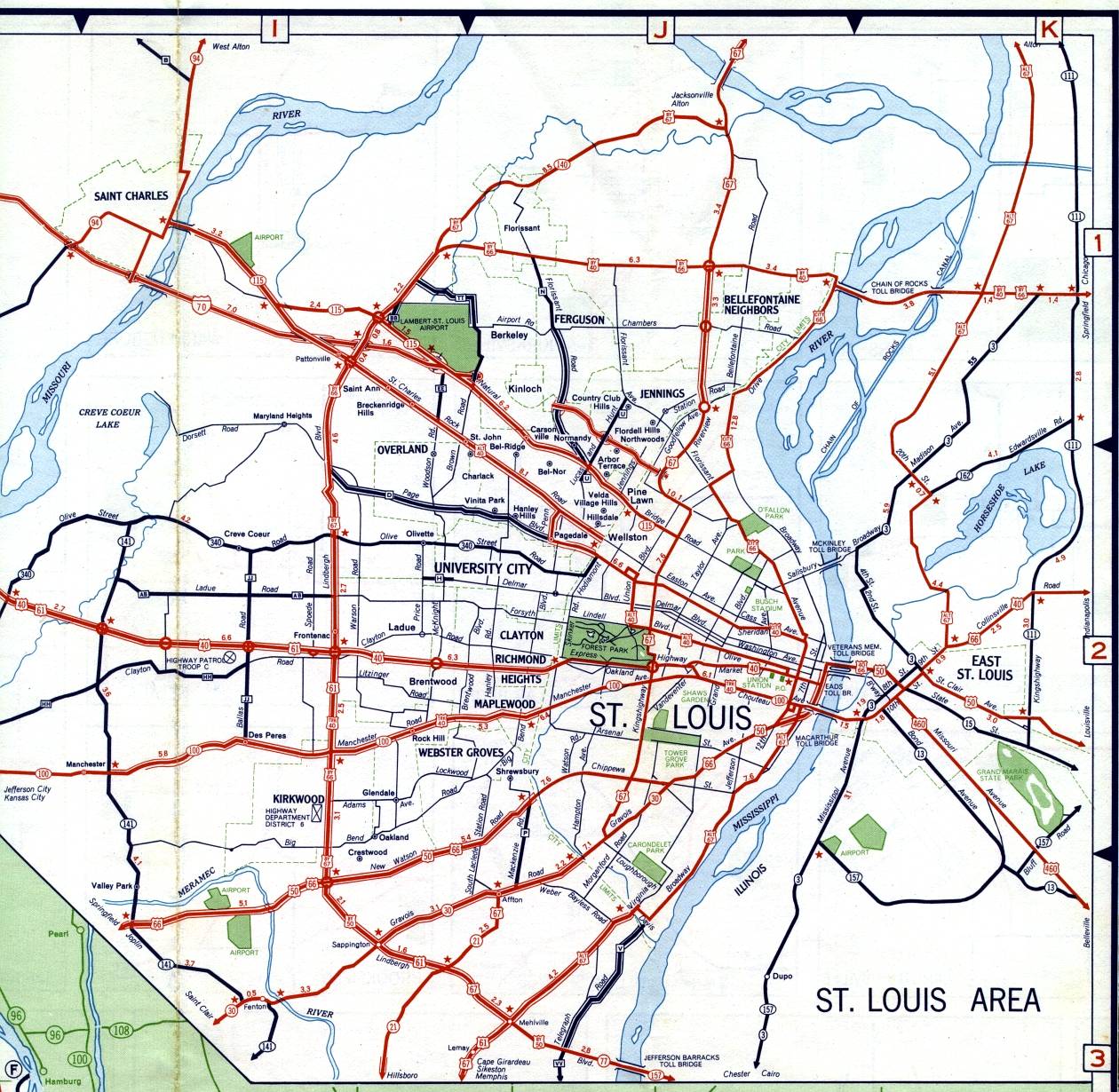
This is the inset map for St. Louis from the 1959 official state highway map. Numbered routes shown on this map included: Interstate 70 (new in 1959), US 40, Alternate US 40, Bypass US 40, City Route 40, Truck Route 40, US 50, Bypass US 50, US 61, US 66, Bypass US 66, US 67, Bypass US 67, Alternate US 67 (in Illinois), Missouri 21, Missouri 30, Missouri 94, Missouri 100, Missouri 115, Missouri 140, Missouri 141, Missouri 340, US 460 (in Illinois), and Illinois state routes. All numbered routes were shown in red except for part of Missouri 94, all of Missouri 141, all of Missouri 340, and all Illinois state routes.
Interstate 70 appeared in northwest St. Louis County from across the river at St. Charles to Brown Road, and again, unlabeled, from Florissant Road near Kinloch, to Lucas and Hunt Road, and onward to US 67 in the city of St. Louis.
Aside from Interstate 70, the other significant change from the 1958 St. Louis inset map was the extension of Missouri 115 west from Lindbergh Boulevard, northwest along the former route of Bypass US 40 to the old St. Charles bridge and ending at Missouri 94 in St. Charles.
Two other changes were the appearance of a very short supplemental route, Route H, on Delmar Boulevard from Price Avenue into University City, and a designation of Missouri 77 on Lindbergh Boulevard just west of the Jefferson Barracks Bridge. The Missouri 77 designation is an error: there was already a Missouri 77 in Scott and Mississippi counties in southeast Missouri.
Freeway interchanges were shown in two different ways on this map. The interchanges for US 40 were shown as thick circles. However, for Interstate 70, the actual ramp configurations were shown. Compare Interstate 70 in the St. Charles area to the use of thick circles on the St. Charles inset map.