Counties in which each endpoint is located are shown in parentheses.
Miniature pseudo-markers are shown for US, Missouri, Interstate, and Interstate Business Loop and Spur Routes (unless you chose the text-only display option). The markers are based on Shield Generator [replaced by Shields Up, (c) 2002 David R. Kendrick] with additional modifications. More about the markers here.
Where available, links are also shown to relevant Road Signs & Sights Gallery photos.
Abbreviations: MO = Missouri Route,
ALT = Alternate Route, SH = State Highway (for states other than
Missouri), SP = Spur Route, SR = Supplemental Route (the secondary
Missouri roads designated with letters).

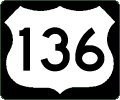
US 136
West Endpoint: Missouri River, 8 mi W of Rock Port (Atchison)
East Endpoint: Des Moines River opposite Keokuk IA (Clark)
Principal Cities: Rock Port, Tarkio, Maryville, Stanberry, Albany, Bethany, Princeton, Unionville, Lancaster, Memphis, Kahoka
Counties: Atchison, Nodaway, Gentry, Harrison, Mercer, Putnam, Schuyler, Scotland, Clark
Derivatives: SP 136
Formerly MO 4 (entire route); US 136 established 1951, western terminus in St Joseph, with MO 4 remaining from Stanberry westward; moved to current route in 1960, entirely replacing MO 4
Road Signs & Sights Gallery Photos
- End of Missouri 146 east of Bethany
- Junction of US 63 and 136 near Lancaster
- Missouri 136 goof for US 136 in Atchison County
- Missouri 145 at US 136 in Mercer County
- Missouri 27 at US 61 in Clark County
- Right-of-way marker in Bethany
- Trailblazer to Iowa 394 on US 61 at US 136 (1998)
- US 136 and Missouri 146 east of Bethany
- US 136 and US 65 concurrence in Princeton
- US 136 and US 71 near Burlington Junction
- US 136 at Interstate 35 in Bethany
- US 136 exit from Missouri 27 in Clark County
- US 136 in Harrison County (1989)
- US 275 and US 136 east of Rock Port
- US 63, US 136, and Missouri 202 near Lancaster
- US 65 and US 136 in Princeton
- US 69, US 136, Interstate 35, and Route W in Bethany
- Unusual left-turn configuration in Bethany
- West Missouri 136 goof for US 136 in Atchison County
Business Route 136
Cities: Albany, Memphis, Kahoka
Spur 136
West Endpoint: US 136, 1 mi SSW of Tarkio (Atchison)
East Endpoint: US 59, 1 mi SSW of Tarkio (Atchison)
Counties: Atchison
Derivative of US 136
Forms a Y junction with US 59 and US 136; former SP 136 in Clark County between US 136 at Wayland and US 61 was closed and replaced by MO 27 in 2004
East Endpoint: US 59, 1 mi SSW of Tarkio (Atchison)
Counties: Atchison
Derivative of US 136
Forms a Y junction with US 59 and US 136; former SP 136 in Clark County between US 136 at Wayland and US 61 was closed and replaced by MO 27 in 2004
Output produced by routelog, program copyright
(c) 1998-2007, Mark Roberts. All rights reserved.
Want to Try Again?
Or look up the types of highways (Interstates, US highways, state highways, or any combination):
