Counties in which each endpoint is located are shown in parentheses.
Miniature pseudo-markers are shown for US, Missouri, Interstate, and Interstate Business Loop and Spur Routes (unless you chose the text-only display option). The markers are based on Shield Generator [replaced by Shields Up, (c) 2002 David R. Kendrick] with additional modifications. More about the markers here.
Where available, links are also shown to relevant Road Signs & Sights Gallery photos.
Abbreviations: MO = Missouri Route,
ALT = Alternate Route, SH = State Highway (for states other than
Missouri), SP = Spur Route, SR = Supplemental Route (the secondary
Missouri roads designated with letters).
Routes 151, 152, 153 ... 200

Missouri 151
North Endpoint: MO 15-MO 156 intersection, 10 mi S of Edina (Knox)
South Endpoint: MO 22 at MO 124 junction, Centralia (Boone)
Principal Cities: Centralia
Counties: Knox, Shelby, Monroe, Audrain, Boone
Intersects with MO 22 twice; designated in 1949, extended in 1955 onto old MO 22 alignment after MO 22 was rerouted west of Centralia
South Endpoint: MO 22 at MO 124 junction, Centralia (Boone)
Principal Cities: Centralia
Counties: Knox, Shelby, Monroe, Audrain, Boone
Intersects with MO 22 twice; designated in 1949, extended in 1955 onto old MO 22 alignment after MO 22 was rerouted west of Centralia
Missouri 152
West Endpoint: I-435 Exit 24 just outside Kansas City (Platte)
East Endpoint: MO 291 near I-35 Exit 16, Liberty (Clay)
Principal Cities: Kansas City, Liberty
Counties: Platte, Clay
Freeway (some segments not fully built) for northern Kansas City; MO 152 formerly designated Barry Road
East Endpoint: MO 291 near I-35 Exit 16, Liberty (Clay)
Principal Cities: Kansas City, Liberty
Counties: Platte, Clay
Freeway (some segments not fully built) for northern Kansas City; MO 152 formerly designated Barry Road
Road Signs & Sights Gallery Photos
Missouri 153
North Endpoint: US 60, 5 mi SSW of Morehouse (Stoddard)
South Endpoint: MO 25, White Oak (Dunklin)
Principal Cities: Gideon
Counties: Stoddard, New Madrid, Dunklin
South Endpoint: MO 25, White Oak (Dunklin)
Principal Cities: Gideon
Counties: Stoddard, New Madrid, Dunklin
Missouri 154
West Endpoint: US 24, 2 mi SW of Paris (Monroe)
East Endpoint: US 54, 3 mi W of Curryville (Pike)
Counties: Monroe, Ralls, Pike
Derivative of US 54
Western segment formerly MO 26
East Endpoint: US 54, 3 mi W of Curryville (Pike)
Counties: Monroe, Ralls, Pike
Derivative of US 54
Western segment formerly MO 26
Road Signs & Sights Gallery Photos
Interstate 155
West Endpoint: I-55 Exit 17 near Hayti (Pemiscot)
East Endpoint: Mississippi River SE of Caruthersville (Pemiscot)
Principal Cities: Caruthersville
Counties: Pemiscot
Derivative of I-55
Continues in Tennessee
East Endpoint: Mississippi River SE of Caruthersville (Pemiscot)
Principal Cities: Caruthersville
Counties: Pemiscot
Derivative of I-55
Continues in Tennessee
Road Signs & Sights Gallery Photos
Missouri 155
Renamed or decommissioned
Now MO 185 between MO 100 and Sullivan (1957), redesignated in 1967; formerly MO 114 from US 66 southward
Now MO 185 between MO 100 and Sullivan (1957), redesignated in 1967; formerly MO 114 from US 66 southward
Missouri 156
West Endpoint: MO 149, 5 mi W of South Gifford (Macon)
East Endpoint: MO 6, Ewing (Lewis)
Principal Cities: La Plata
Counties: Macon, Knox, Lewis
East Endpoint: MO 6, Ewing (Lewis)
Principal Cities: La Plata
Counties: Macon, Knox, Lewis
Missouri 157
North Endpoint: MO 6, 4 mi NW of Kirksville (Adair)
South Endpoint: Thousand Hills State Park (Adair)
Counties: Adair
Park Road
Spur into Thousand Hills State Park
South Endpoint: Thousand Hills State Park (Adair)
Counties: Adair
Park Road
Spur into Thousand Hills State Park
Missouri 158
West Endpoint: US 67, 3 mi W of Harviell (Butler)
East Endpoint: MO 142, 7 mi S of Poplar Bluff (Butler)
Counties: Butler
A short connector
East Endpoint: MO 142, 7 mi S of Poplar Bluff (Butler)
Counties: Butler
A short connector
US 159
North Endpoint: Missouri River E opposite Rulo NE (Holt)
South Endpoint: US 59, 3 mi E of I-29 Exit 79 (Holt)
Counties: Holt
South Endpoint: US 59, 3 mi E of I-29 Exit 79 (Holt)
Counties: Holt
Road Signs & Sights Gallery Photos
US 160
West Endpoint: Kansas line NE of Pittsburg KS (Barton)
East Endpoint: US 67 and MO 158, 3 mi W of Harviell (Butler)
Principal Cities: Lamar, Lockwood, Greenfield, Springfield, Nixa, Forsyth, Gainesville, West Plains, Alton, Doniphan
Counties: Barton, Dade, Greene, Christian, Taney, Ozark, Howell, Oregon, Ripley, Butler
Extended from Springfield to Poplar Bluff in 1954; eastern endpoint formerly at Pine Boulevard (BR 60) and State Street (BR 67) in Poplar Bluff, AASHTO approved truncation to US 67/MO 158 junction in May 2007; route designated by 1931
Road Signs & Sights Gallery Photos
- A Missouri three-digit shield for US 160 with narrow digits
- A cover-up approaching US 60 and US 160 in Springfield
- A wide-style Missouri three-digit shield, rare until 2000
- An add-on for Missouri 13 in Springfield
- Briefly-lived junction of US 160, Missouri 13, and Missouri 248 (2002-2003)
- Business US 67 and US 160 with Missouri 53 trailblazer in Poplar Bluff
- City-made US 160 trailblazers in Springfield
- More gallery pages for US 160
Business Route 160
Cities: Willard
Missouri 161
Northeast Endpoint: US 61, Bowling Green (Pike)
Southwest Endpoint: I-70 Exit 170, Danville (Montgomery)
Principal Cities: Bowling Green, Montgomery City
Counties: Pike, Montgomery
Derivative of US 61
Formerly MO 29, redesignated in 1959
Southwest Endpoint: I-70 Exit 170, Danville (Montgomery)
Principal Cities: Bowling Green, Montgomery City
Counties: Pike, Montgomery
Derivative of US 61
Formerly MO 29, redesignated in 1959
Missouri 162
West Endpoint: MO 25, Clarkton (Dunklin)
East Endpoint: Mississippi River opposite Tiptonville TN (no crossing) (New Madrid)
Principal Cities: Clarkton, Gideon, Portageville
Counties: Dunklin, New Madrid
East Endpoint: Mississippi River opposite Tiptonville TN (no crossing) (New Madrid)
Principal Cities: Clarkton, Gideon, Portageville
Counties: Dunklin, New Madrid
Missouri 163
Northwest Endpoint: I-70 Exit 126, Columbia (Boone)
Southeast Endpoint: US 63, 4 mi SE of Columbia (Boone)
Principal Cities: Columbia
Counties: Boone
Derivative of US 63
Providence Road in Columbia; provides access to Rock Bridge State Park
Southeast Endpoint: US 63, 4 mi SE of Columbia (Boone)
Principal Cities: Columbia
Counties: Boone
Derivative of US 63
Providence Road in Columbia; provides access to Rock Bridge State Park
Road Signs & Sights Gallery Photos
Missouri 164
West Endpoint: US 412, Cardwell (Dunklin)
East Endpoint: Mississippi River at Cottonwood Point (no crossing) (Pemiscot)
Principal Cities: Steele
Counties: Dunklin, Pemiscot
East Endpoint: Mississippi River at Cottonwood Point (no crossing) (Pemiscot)
Principal Cities: Steele
Counties: Dunklin, Pemiscot
Missouri 165
North Endpoint: MO 76, Branson (Taney)
South Endpoint: US 65, Hollister (Taney)
Principal Cities: Branson, Hollister
Counties: Taney
Derivative of US 65
Loops near Table Rock Reservoir
South Endpoint: US 65, Hollister (Taney)
Principal Cities: Branson, Hollister
Counties: Taney
Derivative of US 65
Loops near Table Rock Reservoir
US 166
West Endpoint: Kansas line near Oklahoma-Missouri border (Newton)
East Endpoint: I-44 Exit 1, 5 mi SW of Joplin (Newton)
Counties: Newton
Just one mile in Missouri; duplexed with US 400
East Endpoint: I-44 Exit 1, 5 mi SW of Joplin (Newton)
Counties: Newton
Just one mile in Missouri; duplexed with US 400
Road Signs & Sights Gallery Photos
Missouri 167
No evidence found that this was ever assigned
Missouri 168
West Endpoint: MO 15, Shelbyville (Shelby)
East Endpoint: US 61, 3 mi NW of Hannibal (Marion)
Principal Cities: Shelbyville, Palmyra
Counties: Shelby, Marion
Formerly MO 56, redesignated in 1957
East Endpoint: US 61, 3 mi NW of Hannibal (Marion)
Principal Cities: Shelbyville, Palmyra
Counties: Shelby, Marion
Formerly MO 56, redesignated in 1957
Road Signs & Sights Gallery Photos
US 169
North Endpoint: Iowa line N of Grant City (Worth)
South Endpoint: Kansas line at Intercity Viaduct (I-70, US 24/40), Kansas City (Jackson)
Principal Cities: Grant City, Stanberry, St Joseph, Gower, Smithville, Kansas City
Counties: Worth, Gentry, De Kalb, Andrew, Buchanan, Clinton, Clay, Jackson
Derivatives: SP 169
Realignment along Broadway Extension in Kansas City and over Intercity Viaduct in 1995; originally designated by 1931
Road Signs & Sights Gallery Photos
- All directions at US 169 and Interstate 70 in downtown Kansas City from West 5th Street
- Broadway Bridge in Kansas City as seen from Broadway with 6th Street Trafficway sign downtown
- End of Interstate 635 in Kansas City (1989)
- Exit signs on Interstate 635 at Riverside (1989)
- The standard square Missouri three-digit shield until 2000, on US 169 in Kansas City
- US 169 freeway mileage markers in Kansas City
- Unusual lane shift sign on US 169 near Grayson
- More gallery pages for US 169
Spur 169
North Endpoint: US 169, Smithville (Clay)
South Endpoint: SR F, Smithville (Clay)
Counties: Clay
Derivative of US 169
Not signed at junction, only along route itself
South Endpoint: SR F, Smithville (Clay)
Counties: Clay
Derivative of US 169
Not signed at junction, only along route itself
Road Signs & Sights Gallery Photos
Interstate 170
North Endpoint: I-270 Exit 10, Hazelwood (St Louis)
South Endpoint: US 40 Exit 31, Richmond Heights (St Louis)
Principal Cities: Berkeley, Overland, University City, Clayton
Counties: St Louis
Derivative of I-70
Section from Page Ave (SR D) to US 40 formerly MO 725; locally known as the Inner Belt
South Endpoint: US 40 Exit 31, Richmond Heights (St Louis)
Principal Cities: Berkeley, Overland, University City, Clayton
Counties: St Louis
Derivative of I-70
Section from Page Ave (SR D) to US 40 formerly MO 725; locally known as the Inner Belt
Missouri 170
Renamed or decommissioned
Redesignated MO 190 in 1980
Redesignated MO 190 in 1980
Missouri 171
North Endpoint: Kansas line NW of Carl Junction (Jasper)
South Endpoint: US 71, Carthage (Jasper)
Principal Cities: Joplin, Carterville, Carthage
Counties: Jasper
Derivative of US 71
Continues in Kansas as SH 171 (formerly SH 57, changed by KDOT July 1, 2003)
South Endpoint: US 71, Carthage (Jasper)
Principal Cities: Joplin, Carterville, Carthage
Counties: Jasper
Derivative of US 71
Continues in Kansas as SH 171 (formerly SH 57, changed by KDOT July 1, 2003)
Road Signs & Sights Gallery Photos
- All points of the compass represented by Missouri 96 and Missouri 171, plus Business US 71, near Carthage
- Business Loop 49, Interstate 49, US 71, Missouri 96, and Missouri 171 at the terminus of Missouri 571 in Carthage
- Business Loop 49, Missouri 96, and Missouri 171 in Carthage
- Business US 71 and Missouri 171 near Carthage
- Business US 71, Missouri 171, Missouri 249, and Route HH in Carterville
- Business US 71, Missouri 96, and Missouri 171 near Carthage
- Business US 71, Missouri 96, and Missouri 171 near Carthage (freeway-style sign)
- More gallery pages for Missouri 171
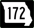
Missouri 172
West Endpoint: US 67, 13 mi S of Greenville (Wayne)
East Endpoint: Lake Wappapello (Wayne)
Counties: Wayne
Park Road
Spur to Wappapello State Park
East Endpoint: Lake Wappapello (Wayne)
Counties: Wayne
Park Road
Spur to Wappapello State Park

Missouri 173
North Endpoint: MO 265/413, Elsey (Stone)
South Endpoint: MO 76, Cape Fair (Stone)
Counties: Stone
Formerly began at US 60 near Marionville and concurrent with MO 13 (now 413) from MO 13 east of Marionville to Elsey, designation changed to MO 265 sometime in the 1990s
South Endpoint: MO 76, Cape Fair (Stone)
Counties: Stone
Formerly began at US 60 near Marionville and concurrent with MO 13 (now 413) from MO 13 east of Marionville to Elsey, designation changed to MO 265 sometime in the 1990s
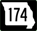
Missouri 174
West Endpoint: MO 39, 2 mi NW of Mount Vernon (Lawrence)
East Endpoint: US 60, Republic (Greene)
Principal Cities: Mount Vernon, Republic
Counties: Lawrence, Greene
East Endpoint: US 60, Republic (Greene)
Principal Cities: Mount Vernon, Republic
Counties: Lawrence, Greene
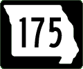
Missouri 175
North Endpoint: MO 86/BR 71 NW of Neosho (Newton)
South Endpoint: US 71 and Business 71, Tipton Ford (Newton)
Counties: Newton
New designation of former US 71 in 1998; route changed again in 2000; formerly decommissioned spur from I-70 at O'Fallon into Fort Zumwalt State Park (no longer a state park)
South Endpoint: US 71 and Business 71, Tipton Ford (Newton)
Counties: Newton
New designation of former US 71 in 1998; route changed again in 2000; formerly decommissioned spur from I-70 at O'Fallon into Fort Zumwalt State Park (no longer a state park)
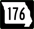
Missouri 176
West Endpoint: MO 248/265/413, Galena (Stone)
East Endpoint: US 160, 2 mi N of Forsyth (Taney)
Principal Cities: Galena, Forsyth
Counties: Stone, Christian, Taney
Derivative of MO 76
East Endpoint: US 160, 2 mi N of Forsyth (Taney)
Principal Cities: Galena, Forsyth
Counties: Stone, Christian, Taney
Derivative of MO 76
Missouri 177
Northwest Endpoint: US 61, 4 mi NE of Jackson (Cape Girardeau)
Southeast Endpoint: MO 34/74 near Mississippi River Bridge, Cape Girardeau (Cape Girardeau)
Principal Cities: Cape Girardeau
Counties: Cape Girardeau
Southeast Endpoint: MO 34/74 near Mississippi River Bridge, Cape Girardeau (Cape Girardeau)
Principal Cities: Cape Girardeau
Counties: Cape Girardeau
Missouri 178
Renamed or decommissioned
Former park road into Johnson's Shut-Ins State Park off former SR M (now SR N) in Reynolds County (shown on 1964 official map as supplemental-grade road)
Former park road into Johnson's Shut-Ins State Park off former SR M (now SR N) in Reynolds County (shown on 1964 official map as supplemental-grade road)
Missouri 179
Northwest Endpoint: MO 98 just N of I-70 Exit 111, 7 mi ESE of Boonville (Cooper)
Southeast Endpoint: US 54, Jefferson City (Cole)
Principal Cities: Jefferson City
Counties: Cooper, Moniteau, Cole
Extended in 2003-04 from US 50 to SR B S of Jefferson City
Southeast Endpoint: US 54, Jefferson City (Cole)
Principal Cities: Jefferson City
Counties: Cooper, Moniteau, Cole
Extended in 2003-04 from US 50 to SR B S of Jefferson City
Road Signs & Sights Gallery Photos
Missouri 180
Northwest Endpoint: I-270, Bridgeton (St Louis)
Southeast Endpoint: Wellston at St Louis city line (St Louis)
Principal Cities: Bridgeton, St Ann, St John, Wellston
Counties: St Louis
Derivatives: SP 180
St Charles Rock Road
Southeast Endpoint: Wellston at St Louis city line (St Louis)
Principal Cities: Bridgeton, St Ann, St John, Wellston
Counties: St Louis
Derivatives: SP 180
St Charles Rock Road
Road Signs & Sights Gallery Photos
Spur 180
North Endpoint: MO 180, Pagedale (St Louis)
South Endpoint: SR D, Page Ave, Pagedale (St Louis)
Counties: St Louis
Derivative of MO 180
Pennsylvania Street
South Endpoint: SR D, Page Ave, Pagedale (St Louis)
Counties: St Louis
Derivative of MO 180
Pennsylvania Street
Road Signs & Sights Gallery Photos
Missouri 181
North Endpoint: BR 60, Cabool (Texas)
South Endpoint: US 160, Gainesville (Ozark)
Principal Cities: Cabool, Gainesville
Counties: Texas, Douglas, Ozark
South Endpoint: US 160, Gainesville (Ozark)
Principal Cities: Cabool, Gainesville
Counties: Texas, Douglas, Ozark
Road Signs & Sights Gallery Photos
Missouri 185
Northwest Endpoint: MO 100, 5 mi E of New Haven (Franklin)
Southeast Endpoint: MO 8, Potosi (Washington)
Principal Cities: Sullivan, Potosi
Counties: Franklin, Washington
Derivatives: SP 185
Formerly MO 155, redesignated in 1967; one section formerly MO 114
Southeast Endpoint: MO 8, Potosi (Washington)
Principal Cities: Sullivan, Potosi
Counties: Franklin, Washington
Derivatives: SP 185
Formerly MO 155, redesignated in 1967; one section formerly MO 114
Road Signs & Sights Gallery Photos
Spur 185
Southwest Endpoint: MO 185, 2 mi E of Sullivan (Franklin)
Northeast Endpoint: Meramec State Park (Franklin)
Counties: Franklin
Derivative of MO 185
Spur into Meramec State Park
Northeast Endpoint: Meramec State Park (Franklin)
Counties: Franklin
Derivative of MO 185
Spur into Meramec State Park
Missouri 187
West Endpoint: Boone's Lick State Park (Howard)
East Endpoint: MO 87, Boonesboro (Howard)
Counties: Howard
Park Road Derivative of MO 87
Spur into Boone's Lick State Park
East Endpoint: MO 87, Boonesboro (Howard)
Counties: Howard
Park Road Derivative of MO 87
Spur into Boone's Lick State Park
Missouri 190
Northeast Endpoint: MO 146, Edinburg (Grundy)
Southeast Endpoint: US 65, 3 mi N of Chillicothe (Livingston)
Counties: Grundy, Livingston
Formerly MO 170; first designated in 1957 (as MO 170); redesignated MO 190 in 1980; section from Jamesport to near Trenton is old MO 6
Southeast Endpoint: US 65, 3 mi N of Chillicothe (Livingston)
Counties: Grundy, Livingston
Formerly MO 170; first designated in 1957 (as MO 170); redesignated MO 190 in 1980; section from Jamesport to near Trenton is old MO 6
Road Signs & Sights Gallery Photos
Note: there are no routes in Missouri numbered:
182, 183, 184, 186, 188, 189, 191, 192, 193, 194, 195, 196, 197, 198, 199, 200
Output produced by routelog, program copyright
(c) 1998-2007, Mark Roberts. All rights reserved.
Want to Try Again?
Or look up the types of highways (Interstates, US highways, state highways, or any combination):
