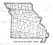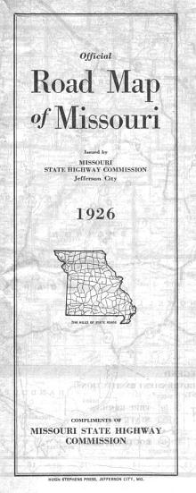
The front covers of early Missouri official highway maps were plain, such as the cover for the 1926 "Official Road Map of Missouri". The illustration is a thumbnail drawing of the original state highway system, the Centennial Road System, with the caption "7640 miles of state roads".
After the Centennial Road System was established in 1922, Missouri made rapid progress toward building its highway system. Official road maps from the 1920s and early 1930s show how the system was built out in its first years.
This page features detailed scans of official state maps from 1926, 1927, 1928, 1929, 1930, 1932, and 1936. In addition, an official weekly detour map for the first week of November 1935 is featured. Comparing the routes depicted on the maps is a great way of seeing how quickly the modern Missouri highway system was built.
The maps are scanned in sections. G.R. Van has created full-sized one-piece scans of the 1926 official map, front and back, at his web site, My Land of Misery.
1926
The 1926 map was the first map after the system of U.S. routes was established. The map was somewhat hard to read, with routes shown in orange overlaid on a rather busy map that even showed all civil township lines in the state. County boundaries were shown in green. All routes were shown with a circle symbol. There was no differentiation between U.S. routes and state routes. Some state routes had not yet become U.S. highways. For example, US 24 and US 54 were not designated until 1927.
In addition, what was later US 66 was designated US 60, and the present US 60 was designated US 62. The supplemental route system had not yet been created. That wouldn't happen until 1931. The nearest equivalent to supplemental routes would have been spur routes that were designated with the number of their parent highway plus a letter suffix, similar to the system in use today in Oklahoma.
From this page, you can access fair use excerpts of the map. Due to its age, the folds are noticeable, but the map itself is in very good condition. These are large scans, running around 300-400 KB, necessary in order to show the detail on the map. The areas shown by the scans overlap.
U.S. Route Maps in 1926
On the reverse side of the 1926 map were maps of the cross-state U.S. routes that had been designated. The numbered state routes that had been supplanted by the U.S. route designations were indicated on each map. On each map, even though the U.S. route marker shield was depicted, the maps themselves were still drawn using a circle as the route symbol for each route. U.S. routes were distinguished with a small "US" drawn in the symbol.
Some of the route numbers were to undergo still more changes. In 1926, what was later US 66 was designated US 60, and the present US 60 was designated US 62.
A small inset showed routes in Kansas City and St. Louis along with the traffic signs in use in Missouri. Note that Missouri had not yet adopted the state outline as the marker for numbered routes.
Not all U.S. routes were shown. US 67 and US 69 were designated by this time, but they were not considered to be cross-state routes. Even though US 62's western endpoint was in Springfield, it evidently was considered a cross-state route. US 24 and US 54 were not designated until 1927.
Maps for US 61, US 63, US 65, and US 71 were drawn in a manner that indicated they should be read vertically, but they were oriented horizontally on the map. In the scans on this site, I've shown each of the route maps oriented in what I believe is the intended manner. The maps are shown at 150 dpi resolution.
- US 36
- US 40 and US 50
- US 60 (later US 66)
- US 61
- US 62 (later US 60)
- US 63
- US 65
- US 71
- Kansas City and St. Louis inset maps
- Maps not drawn: US 67 and US 69
1927
The 1927 map was similar to the 1926 map. Even though routes were overlaid on the same map as the 1926 version, the background map was printed in a gray ink, with routes shown in red. Thus, it's much easier to read than the 1926 map. As in 1926, all routes were shown with a circle symbol with no differentiation between U.S. routes and state routes. US 24 and US 54 had been designated by this time. US 60 and US 66 assumed their longstanding designations by 1927 as well.
This map is also in very good condition even though the folds are noticeable. Due to its age, the folds are noticeable, but the map itself is in very good condition. These are large scans, running around 300-400 KB, necessary in order to show the detail on the map. The areas shown by the scans overlap.
U.S. Route Maps in 1927
As with the 1926 map, the 1927 map also featured route maps of the cross-state U.S. routes that had been designated. Unlike the 1926 map, the numbered state routes that had been supplanted by the U.S. route designations were not indicated on each map. Still, on each map, even though the U.S. route marker shield was depicted, the maps themselves were still drawn using a circle as the route symbol for each route. U.S. routes were distinguished with a small "US" drawn in the symbol.
A small inset showed routes in Kansas City and St. Louis along with the traffic signs in use in Missouri, the same as the 1926 map.
The same U.S. routes were shown as in 1926. By this time, US 60 had become US 66 and US 62 was given its modern designation of US 60. The new US routes, US 24 and US 54, were not shown.
A comparison of the 1926 route maps and the 1927 route maps clearly shows how rapidly routes were paved and otherwise improved in the state.
As in 1926, maps for US 61, US 63, US 65, and US 71 were drawn in a manner that indicated they should be read vertically, but they were oriented horizontally on the map. In the scans on this site, I've shown each of the route maps oriented in what I believe is the intended manner. The maps are shown at 150 dpi resolution.
- US 36
- US 40 and US 50
- US 60 (previously US 62)
- US 61
- US 63
- US 65
- US 66 (previously US 60)
- US 71
- Kansas City and St. Louis inset maps
- Maps not drawn for US 24, US 54, US 67, US 69
1928
The 1928 map was the first map entirely drawn by the state highway department. It's much simpler and easier to read than the 1926 or 1927 maps. Comparing this map to those of earlier years, you can see the Missouri highway system taking shape, though gaps remained in more than a few areas.
The 1928 map was also the first Missouri map to use the shield to indicate U.S. routes. Missouri state routes were indicated by a number alongside the route.
This map is in very good condition. These are moderately large scans, running around 200 KB, necessary in order to show the detail on the map. The areas shown by the scans overlap.
U.S. Route Logs in 1928
 Rather than the route maps used in 1926
and 1927, the reverse side of the 1928 map
displayed a series of mileage logs for all the U.S. routes in
Missouri.
Rather than the route maps used in 1926
and 1927, the reverse side of the 1928 map
displayed a series of mileage logs for all the U.S. routes in
Missouri.
The small inset showing routes in Kansas City and St. Louis along with typical Missouri traffic signs was retained from the maps of previous years.
1929
The 1929 map was similar to the 1928 map. There were no major changes to the state highway system between 1928 and 1929. The map does show steady progress in constructing the state road system. The US route logs on the reverse side of the map covered the same routes as on the 1928 map.
This map is in good condition. These are moderately large scans, running around 200 KB, necessary in order to show the detail on the map. The areas shown by the scans overlap.
1930
The 1930 map was similar to the 1928 and 1929 maps. The most notable change was the elimination of most suffixed routes. A good set of examples is in northwest Missouri along what was then Missouri 1. Missouri 102 was formerly MO 1A, MO 111 had been MO 1C, MO 113 had been MO 1D, MO 120 had been MO 1E, and MO 118 had been MO 1F. Near Hannibal, MO 9A had become MO 56. West of Jefferson City, MO 12A was renumbered as MO 87; east of Jefferson City, MO 12B became MO 89.
There were no other big changes from 1929; you can see yet more progress on construction of the Missouri highway system. The US route logs on the reverse side of the map covered the same routes as on the 1928 and 1929 maps. These are moderately large scans, running around 200 KB, necessary in order to show the detail on the map. The areas shown by the scans overlap.
1932, Including Supplemental Routes
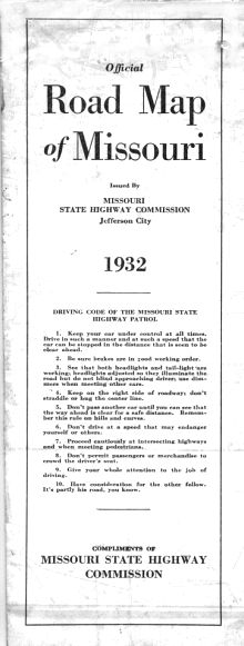
The cover for the 1932 "Official Road Map of Missouri" no longer had a thumbnail drawing of the state highway system. Instead, there was the "Driving Code of the Missouri State Highway Patrol".
The 1932 map was the first to show the supplemental route system, construction on which was just starting. No supplemental routes had yet been paved. The map was also the first to use the state-outline marker to designate state routes.
Additional US routes had been added to the Missouri system by 1932:
- US 275 had supplanted Missouri 1 in northwest Missouri north of St. Joseph. US 275's southern endpoint was in St. Joseph. Curiously, there was no mileage log for US 275 on the 1932 map.
- US 169 was a new route in northwest Missouri, concurrent with MO 4 between the Iowa line and St. Joseph but also replacing MO 29 in Gentry and Worth counties. South of St. Joseph, US 169 replaced Missouri 1. That section of Missouri 1 had earlier been displaced by US 71, with the MO 1 designation moving to state routes 50 and 33. US 169's southern endpoint was at US 69 north of Kansas City.
- US 62 had been added in the Bootheel, concurrent with US 60 from Sikeston eastward, concurrent with US 61 between Sikeston and New Madrid, replacing MO 82 in New Madrid County, and designating a new route in the area around Campbell.
- US 160 made its appearance in southwest Missouri, mostly superseding MO 38 but also concurrent with MO 13 between Republic and Springfield. Its eastern endpoint was in Springfield.
- In the Joplin and Carthage area, what later became Alternate US 71 appeared as Optional US 71.
All these routes appeared first on the 1931 map. I haven't scanned my copy of that map because it is in poor, fragile condition.
My copy of the 1932 map is in mostly good condition, with a few marks. However, the folds seem to be more fragile than shown on the scans. These are moderately large scans, running around 200 KB, necessary in order to show the detail on the map. The areas shown by the scans overlap.
1935 Weekly Detour Map
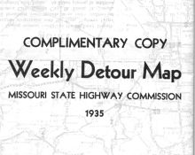
The cover for this 1935 map showing the weekly status of road conditions and detours was plain, to say the least. Except for this title, all the printing on the map was on the other side.
The 1935 map is different from the others in the collection. It's a map that was published weekly by the highway commission, showing detours and other notable travel conditions in the state for the upcoming week. A yearly subscription to the map cost $1.60.
By this time, the annual official map may have been published in color. The 1934 map was in black-and-white. I don't have official maps for 1935 (except for this road-condition map). The 1936 map was in color, and, by 1937, even the cover of the map was in color. This map was in color, too, though with an unusual scheme. The base of the map, including roads, cities, and state boundaries, was printed in red. Rivers and county lines were shown in blue. Numbers and symbols in black indicated detours along with the types of road work and road conditions associated with those detours. A separate legend explained the symbols and the numbers.
1936
The 1936 map was similar to maps of previous years, except that the main state map was in color, or at least some color. The color green was still absent (parks were shown in red). It was also the last year with a plain cover. By 1937, the map was in full color and the cover was in color, too, beginning a long run of pictorial covers that continues to this day.
The 1936 map also included larger-scale inset maps of the Kansas City and St. Louis metropolitan areas. The insets were still on the front side of the map; they wouldn't move to the other side until the next year. On the back side of the map, there were the US route logs, a feature first included in 1928, covering all the US routes in the state (you can see the 1937 route logs along with the rest of the 1937 map).
These are moderately large scans, running around 600 KB, necessary in order to show the detail on the map. The areas shown by the scans overlap.
Other Historic Maps
Gathered in this section are a couple of other historic maps from even earlier days of the Missouri highway system:
- 1922 Missouri Highway Commission map (courtesy of David Backlin)
- 1923 Missouri road map in the official state manual